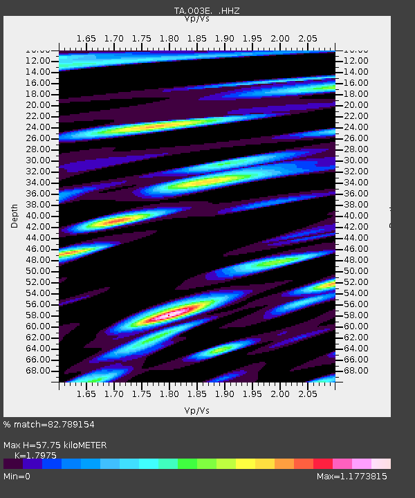
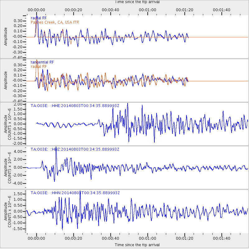
O03E Paynes Creek, CA, USA - Earthquake Result Viewer

Earthquake location: E. Caroline Islands, Micronesia
Earthquake latitude/longitude: 0.8/146.1
Earthquake time(UTC): 2014/08/03 (215) 00:22:03 GMT
Earthquake Depth: 11 km
Earthquake Magnitude: 6.9 MWW, 6.8 MWB, 6.9 MWC, 7.2 MI
Earthquake Catalog/Contributor: NEIC PDE/NEIC COMCAT
Network: TA USArray Transportable Network (new EarthScope stations)
Station: O03E Paynes Creek, CA, USA
Lat/Lon: 40.29 N/121.80 W
Elevation: 967 m
Distance: 91.0 deg
Az: 49.862 deg
Baz: 271.964 deg
Ray Param: 0.04163104
Estimated Moho Depth: 57.75 km
Estimated Crust Vp/Vs: 1.80
Assumed Crust Vp: 6.566 km/s
Estimated Crust Vs: 3.653 km/s
Estimated Crust Poisson's Ratio: 0.28
Radial Match: 82.789154 %
Radial Bump: 400
Transverse Match: 84.80401 %
Transverse Bump: 400
SOD ConfigId: 769524
Insert Time: 2014-08-17 01:00:26.701 +0000
GWidth: 2.5
Max Bumps: 400
Tol: 0.001

Signal To Noise

ChannelStoNSTALTA
TA:O03E: :HHZ:20140803T00:34:35.889993Z6.99894675.3006164E-77.573449E-8
TA:O03E: :HHN:20140803T00:34:35.889993Z0.715790759.054802E-81.2650068E-7
TA:O03E: :HHE:20140803T00:34:35.889993Z1.40401481.9221397E-71.369031E-7
Arrivals
Ps7.2 SECOND
PpPs24 SECOND
PsPs/PpSs31 SECOND