A21K Barrow, AK, USA - Earthquake Result Viewer
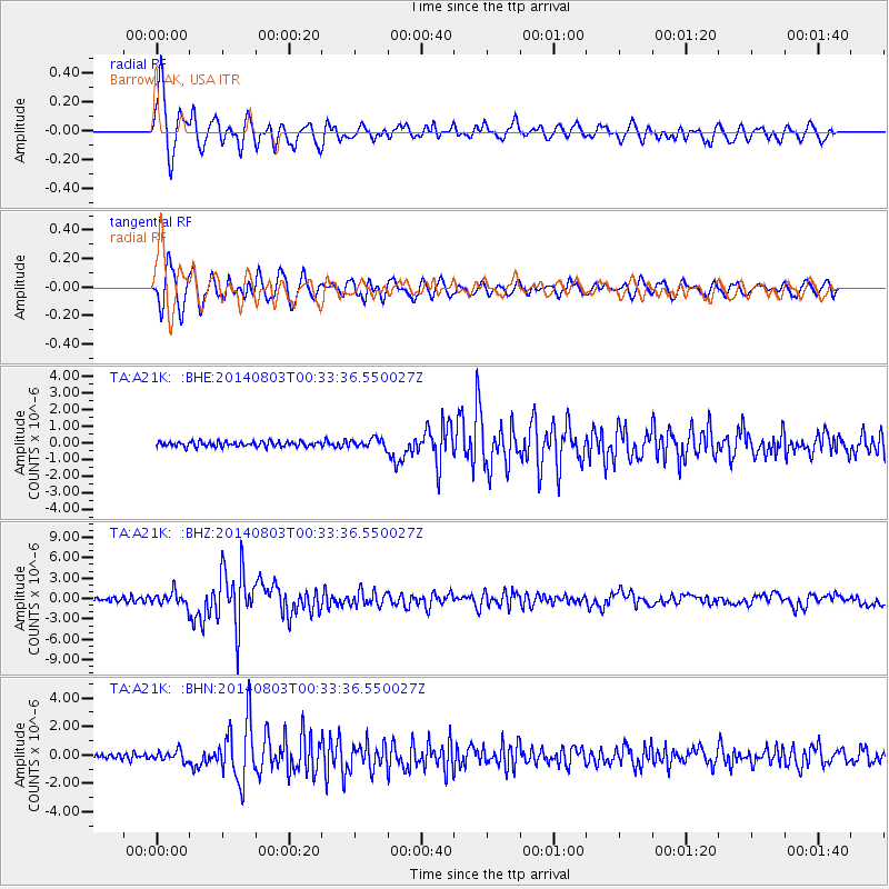
Earthquake location: E. Caroline Islands, Micronesia
Earthquake latitude/longitude: 0.8/146.1
Earthquake time(UTC): 2014/08/03 (215) 00:22:03 GMT
Earthquake Depth: 11 km
Earthquake Magnitude: 6.9 MWW, 6.8 MWB, 6.9 MWC, 7.2 MI
Earthquake Catalog/Contributor: NEIC PDE/NEIC COMCAT
Network: TA USArray Transportable Network (new EarthScope stations)
Station: A21K Barrow, AK, USA
Lat/Lon: 71.32 N/156.62 W
Elevation: 577 m
Distance: 79.2 deg
Az: 16.013 deg
Baz: 238.885 deg
Ray Param: 0.049154747
Estimated Moho Depth: 42.5 km
Estimated Crust Vp/Vs: 1.79
Assumed Crust Vp: 6.048 km/s
Estimated Crust Vs: 3.379 km/s
Estimated Crust Poisson's Ratio: 0.27
Radial Match: 92.9142 %
Radial Bump: 400
Transverse Match: 88.573685 %
Transverse Bump: 400
SOD ConfigId: 769524
Insert Time: 2014-08-17 01:00:46.811 +0000
GWidth: 2.5
Max Bumps: 400
Tol: 0.001

Signal To Noise

ChannelStoNSTALTA
TA:A21K: :BHZ:20140803T00:33:36.550027Z3.52295339.670251E-72.7449275E-7
TA:A21K: :BHN:20140803T00:33:36.550027Z1.73817843.701574E-72.1295709E-7
TA:A21K: :BHE:20140803T00:33:36.550027Z1.73705222.691902E-71.5496956E-7
Arrivals
Ps5.7 SECOND
PpPs19 SECOND
PsPs/PpSs25 SECOND