SHAA Shaartuz, Tajikistan - Earthquake Result Viewer
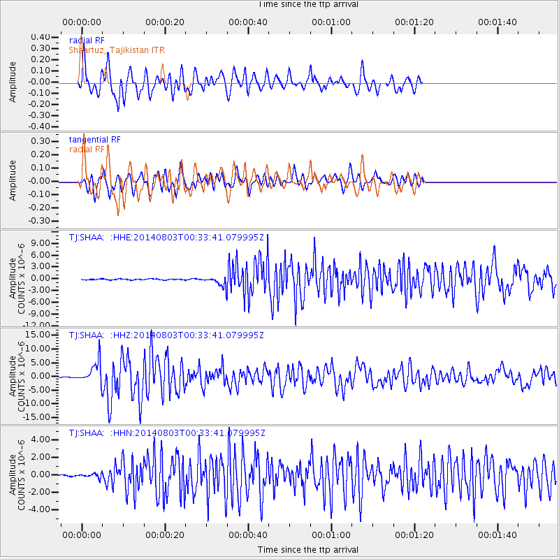
Earthquake location: E. Caroline Islands, Micronesia
Earthquake latitude/longitude: 0.8/146.1
Earthquake time(UTC): 2014/08/03 (215) 00:22:03 GMT
Earthquake Depth: 11 km
Earthquake Magnitude: 6.9 MWW, 6.8 MWB, 6.9 MWC, 7.2 MI
Earthquake Catalog/Contributor: NEIC PDE/NEIC COMCAT
Network: TJ Tajikistan National Seismic Network
Station: SHAA Shaartuz, Tajikistan
Lat/Lon: 37.56 N/68.12 E
Elevation: 868 m
Distance: 80.0 deg
Az: 307.873 deg
Baz: 96.668 deg
Ray Param: 0.04858041
Estimated Moho Depth: 43.0 km
Estimated Crust Vp/Vs: 1.91
Assumed Crust Vp: 6.213 km/s
Estimated Crust Vs: 3.249 km/s
Estimated Crust Poisson's Ratio: 0.31
Radial Match: 83.50254 %
Radial Bump: 400
Transverse Match: 73.03056 %
Transverse Bump: 400
SOD ConfigId: 769524
Insert Time: 2014-08-17 01:01:34.526 +0000
GWidth: 2.5
Max Bumps: 400
Tol: 0.001

Signal To Noise

ChannelStoNSTALTA
TJ:SHAA: :HHZ:20140803T00:33:41.079995Z32.0907364.1413964E-61.2905271E-7
TJ:SHAA: :HHN:20140803T00:33:41.079995Z2.05562572.1940167E-71.0673231E-7
TJ:SHAA: :HHE:20140803T00:33:41.079995Z9.5307071.1239055E-61.17924664E-7
Arrivals
Ps6.5 SECOND
PpPs20 SECOND
PsPs/PpSs26 SECOND