BMO Blue Mountains Array (Baker), Oregon, USA - Earthquake Result Viewer
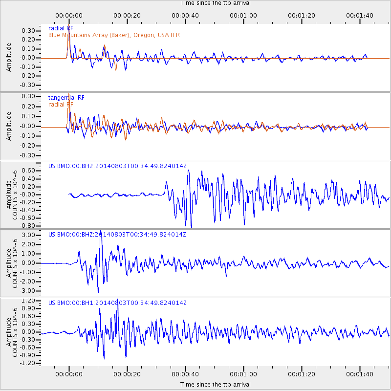
Earthquake location: E. Caroline Islands, Micronesia
Earthquake latitude/longitude: 0.8/146.1
Earthquake time(UTC): 2014/08/03 (215) 00:22:03 GMT
Earthquake Depth: 11 km
Earthquake Magnitude: 6.9 MWW, 6.8 MWB, 6.9 MWC, 7.2 MI
Earthquake Catalog/Contributor: NEIC PDE/NEIC COMCAT
Network: US United States National Seismic Network
Station: BMO Blue Mountains Array (Baker), Oregon, USA
Lat/Lon: 44.85 N/117.31 W
Elevation: 1189 m
Distance: 94.1 deg
Az: 45.111 deg
Baz: 275.21 deg
Ray Param: 0.04113088
Estimated Moho Depth: 16.5 km
Estimated Crust Vp/Vs: 1.80
Assumed Crust Vp: 6.571 km/s
Estimated Crust Vs: 3.65 km/s
Estimated Crust Poisson's Ratio: 0.28
Radial Match: 94.55908 %
Radial Bump: 400
Transverse Match: 92.46072 %
Transverse Bump: 400
SOD ConfigId: 769524
Insert Time: 2014-08-17 01:02:15.099 +0000
GWidth: 2.5
Max Bumps: 400
Tol: 0.001

Signal To Noise

ChannelStoNSTALTA
US:BMO:00:BHZ:20140803T00:34:49.824014Z11.3551674.3815064E-73.8586016E-8
US:BMO:00:BH1:20140803T00:34:49.824014Z3.1364918.632653E-82.7523281E-8
US:BMO:00:BH2:20140803T00:34:49.824014Z4.4944681.1653521E-72.5928587E-8
Arrivals
Ps2.1 SECOND
PpPs6.9 SECOND
PsPs/PpSs8.9 SECOND