GNW Green Mountain (BB) - Earthquake Result Viewer
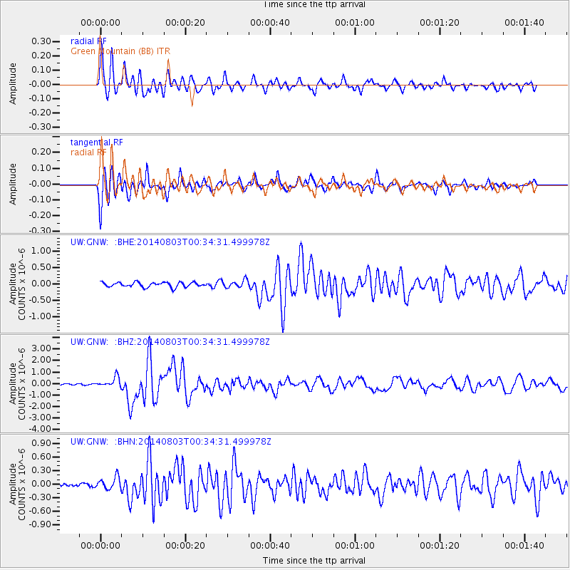
Earthquake location: E. Caroline Islands, Micronesia
Earthquake latitude/longitude: 0.8/146.1
Earthquake time(UTC): 2014/08/03 (215) 00:22:03 GMT
Earthquake Depth: 11 km
Earthquake Magnitude: 6.9 MWW, 6.8 MWB, 6.9 MWC, 7.2 MI
Earthquake Catalog/Contributor: NEIC PDE/NEIC COMCAT
Network: UW Pacific Northwest Regional Seismic Network
Station: GNW Green Mountain (BB)
Lat/Lon: 47.56 N/122.83 W
Elevation: 160 m
Distance: 90.1 deg
Az: 42.619 deg
Baz: 271.326 deg
Ray Param: 0.041698746
Estimated Moho Depth: 22.25 km
Estimated Crust Vp/Vs: 1.76
Assumed Crust Vp: 6.566 km/s
Estimated Crust Vs: 3.72 km/s
Estimated Crust Poisson's Ratio: 0.26
Radial Match: 91.90185 %
Radial Bump: 400
Transverse Match: 89.34312 %
Transverse Bump: 400
SOD ConfigId: 769524
Insert Time: 2014-08-17 01:04:13.497 +0000
GWidth: 2.5
Max Bumps: 400
Tol: 0.001

Signal To Noise

ChannelStoNSTALTA
UW:GNW: :BHZ:20140803T00:34:31.499978Z7.2209134.5343646E-76.279489E-8
UW:GNW: :BHN:20140803T00:34:31.499978Z3.41218351.3788818E-74.041054E-8
UW:GNW: :BHE:20140803T00:34:31.499978Z1.58155081.1392249E-77.203214E-8
Arrivals
Ps2.6 SECOND
PpPs9.2 SECOND
PsPs/PpSs12 SECOND