UMAT Pilot Rock, OR, USA - Earthquake Result Viewer
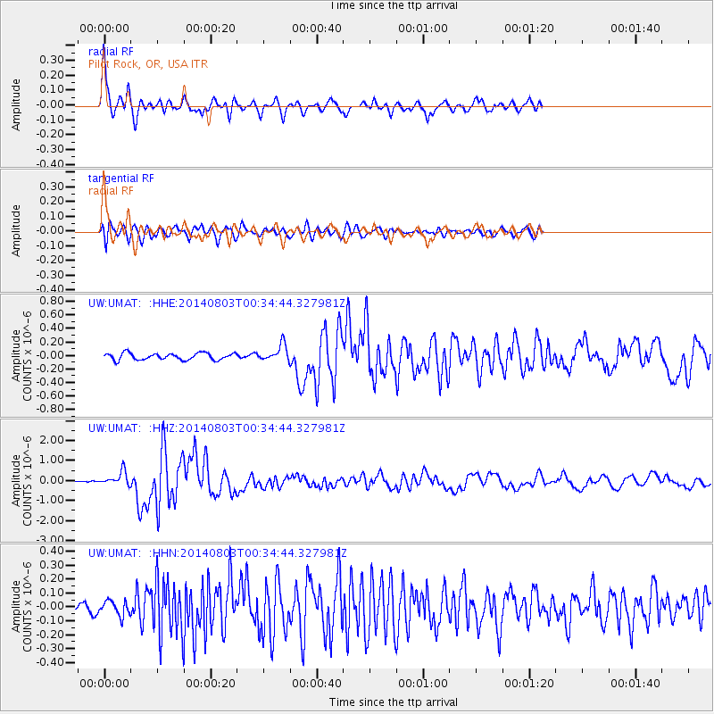
Earthquake location: E. Caroline Islands, Micronesia
Earthquake latitude/longitude: 0.8/146.1
Earthquake time(UTC): 2014/08/03 (215) 00:22:03 GMT
Earthquake Depth: 11 km
Earthquake Magnitude: 6.9 MWW, 6.8 MWB, 6.9 MWC, 7.2 MI
Earthquake Catalog/Contributor: NEIC PDE/NEIC COMCAT
Network: UW Pacific Northwest Regional Seismic Network
Station: UMAT Pilot Rock, OR, USA
Lat/Lon: 45.29 N/118.96 W
Elevation: 1318 m
Distance: 92.9 deg
Az: 44.765 deg
Baz: 274.063 deg
Ray Param: 0.04137495
Estimated Moho Depth: 36.25 km
Estimated Crust Vp/Vs: 1.81
Assumed Crust Vp: 6.571 km/s
Estimated Crust Vs: 3.64 km/s
Estimated Crust Poisson's Ratio: 0.28
Radial Match: 91.329285 %
Radial Bump: 369
Transverse Match: 83.85723 %
Transverse Bump: 400
SOD ConfigId: 769524
Insert Time: 2014-08-17 01:05:23.309 +0000
GWidth: 2.5
Max Bumps: 400
Tol: 0.001

Signal To Noise

ChannelStoNSTALTA
UW:UMAT: :HHZ:20140803T00:34:44.327981Z6.6783633.5295275E-75.2850194E-8
UW:UMAT: :HHN:20140803T00:34:44.327981Z1.7928365.2949062E-82.9533691E-8
UW:UMAT: :HHE:20140803T00:34:44.327981Z2.41377261.2035845E-74.986321E-8
Arrivals
Ps4.5 SECOND
PpPs15 SECOND
PsPs/PpSs20 SECOND