You are here: Home > Network List > AV - Alaska Volcano Observatory Stations List
> Station MAPS Pakushin Southeast, Makushin Volcano, Alaska > Earthquake Result Viewer
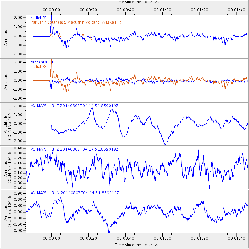
MAPS Pakushin Southeast, Makushin Volcano, Alaska - Earthquake Result Viewer
*The percent match for this event was below the threshold and hence no stack was calculated.
| Earthquake location: |
Ryukyu Islands, Japan |
| Earthquake latitude/longitude: |
28.0/128.1 |
| Earthquake time(UTC): |
2014/08/03 (215) 04:06:04 GMT |
| Earthquake Depth: |
10 km |
| Earthquake Magnitude: |
5.7 MWP |
| Earthquake Catalog/Contributor: |
NEIC PDE/NEIC COMCAT |
|
| Network: |
AV Alaska Volcano Observatory |
| Station: |
MAPS Pakushin Southeast, Makushin Volcano, Alaska |
| Lat/Lon: |
53.81 N/166.94 W |
| Elevation: |
333 m |
|
| Distance: |
53.2 deg |
| Az: |
42.113 deg |
| Baz: |
268.28 deg |
| Ray Param: |
$rayparam |
*The percent match for this event was below the threshold and hence was not used in the summary stack. |
|
| Radial Match: |
66.869995 % |
| Radial Bump: |
367 |
| Transverse Match: |
59.073097 % |
| Transverse Bump: |
400 |
| SOD ConfigId: |
769524 |
| Insert Time: |
2014-08-17 04:29:04.823 +0000 |
| GWidth: |
2.5 |
| Max Bumps: |
400 |
| Tol: |
0.001 |
|
Signal To Noise
| Channel | StoN | STA | LTA |
| AV:MAPS: :BHZ:20140803T04:14:51.859019Z | 2.0245543 | 2.6583106E-7 | 1.3130351E-7 |
| AV:MAPS: :BHN:20140803T04:14:51.859019Z | 1.9998065 | 5.417813E-7 | 2.7091684E-7 |
| AV:MAPS: :BHE:20140803T04:14:51.859019Z | 1.7951024 | 1.3722539E-6 | 7.6444326E-7 |
| Arrivals |
| Ps | |
| PpPs | |
| PsPs/PpSs | |


