You are here: Home > Network List > UU - University of Utah Regional Network Stations List
> Station KNB Kanab, UT, USA > Earthquake Result Viewer
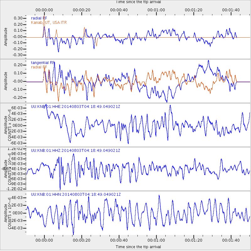
KNB Kanab, UT, USA - Earthquake Result Viewer
*The percent match for this event was below the threshold and hence no stack was calculated.
| Earthquake location: |
Ryukyu Islands, Japan |
| Earthquake latitude/longitude: |
28.0/128.1 |
| Earthquake time(UTC): |
2014/08/03 (215) 04:06:04 GMT |
| Earthquake Depth: |
10 km |
| Earthquake Magnitude: |
5.7 MWP |
| Earthquake Catalog/Contributor: |
NEIC PDE/NEIC COMCAT |
|
| Network: |
UU University of Utah Regional Network |
| Station: |
KNB Kanab, UT, USA |
| Lat/Lon: |
37.02 N/112.82 W |
| Elevation: |
1715 m |
|
| Distance: |
93.6 deg |
| Az: |
44.504 deg |
| Baz: |
309.27 deg |
| Ray Param: |
$rayparam |
*The percent match for this event was below the threshold and hence was not used in the summary stack. |
|
| Radial Match: |
57.602295 % |
| Radial Bump: |
400 |
| Transverse Match: |
52.93349 % |
| Transverse Bump: |
400 |
| SOD ConfigId: |
769524 |
| Insert Time: |
2014-08-17 04:42:45.473 +0000 |
| GWidth: |
2.5 |
| Max Bumps: |
400 |
| Tol: |
0.001 |
|
Signal To Noise
| Channel | StoN | STA | LTA |
| UU:KNB:01:HHZ:20140803T04:18:49.049021Z | 1.5636635 | 3.0125122E-9 | 1.9265733E-9 |
| UU:KNB:01:HHN:20140803T04:18:49.049021Z | 1.5172855 | 2.2896027E-9 | 1.5090126E-9 |
| UU:KNB:01:HHE:20140803T04:18:49.049021Z | 0.49832335 | 1.5658121E-9 | 3.142161E-9 |
| Arrivals |
| Ps | |
| PpPs | |
| PsPs/PpSs | |


