You are here: Home > Network List > II - Global Seismograph Network (GSN - IRIS/IDA) Stations List
> Station MSEY Mahe, Seychelles > Earthquake Result Viewer
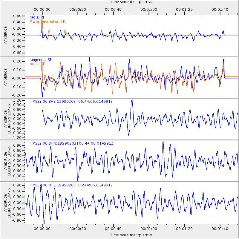
MSEY Mahe, Seychelles - Earthquake Result Viewer
*The percent match for this event was below the threshold and hence no stack was calculated.
| Earthquake location: |
Sunda Strait, Indonesia |
| Earthquake latitude/longitude: |
-6.2/104.2 |
| Earthquake time(UTC): |
1999/02/03 (034) 06:35:56 GMT |
| Earthquake Depth: |
33 km |
| Earthquake Magnitude: |
5.6 MB, 5.6 MS, 5.8 MW, 5.7 MW |
| Earthquake Catalog/Contributor: |
WHDF/NEIC |
|
| Network: |
II Global Seismograph Network (GSN - IRIS/IDA) |
| Station: |
MSEY Mahe, Seychelles |
| Lat/Lon: |
4.67 S/55.48 E |
| Elevation: |
475 m |
|
| Distance: |
48.5 deg |
| Az: |
269.23 deg |
| Baz: |
94.109 deg |
| Ray Param: |
$rayparam |
*The percent match for this event was below the threshold and hence was not used in the summary stack. |
|
| Radial Match: |
51.922634 % |
| Radial Bump: |
400 |
| Transverse Match: |
46.12492 % |
| Transverse Bump: |
400 |
| SOD ConfigId: |
4480 |
| Insert Time: |
2010-03-02 00:42:02.558 +0000 |
| GWidth: |
2.5 |
| Max Bumps: |
400 |
| Tol: |
0.001 |
|
Signal To Noise
| Channel | StoN | STA | LTA |
| II:MSEY:00:BHN:19990203T06:44:06.014991Z | 0.7875507 | 3.52155E-7 | 4.471522E-7 |
| II:MSEY:00:BHE:19990203T06:44:06.014991Z | 2.244439 | 6.3598196E-7 | 2.8335901E-7 |
| II:MSEY:00:BHZ:19990203T06:44:06.014991Z | 0.3402426 | 9.425843E-8 | 2.7703302E-7 |
| Arrivals |
| Ps | |
| PpPs | |
| PsPs/PpSs | |


