You are here: Home > Network List > UW - Pacific Northwest Regional Seismic Network Stations List
> Station MRBL Marblemount, WA, USA > Earthquake Result Viewer
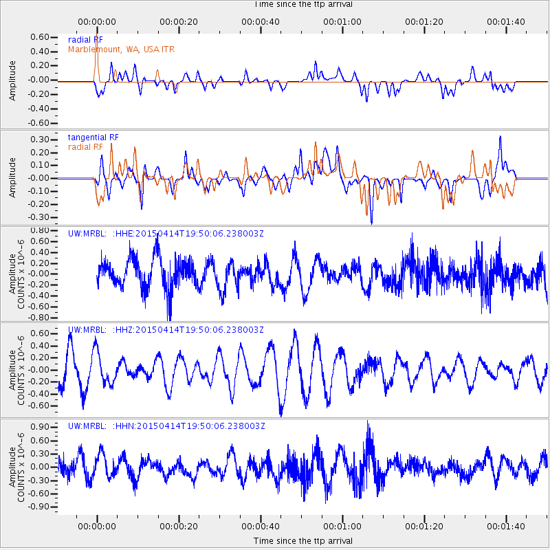
MRBL Marblemount, WA, USA - Earthquake Result Viewer
*The percent match for this event was below the threshold and hence no stack was calculated.
| Earthquake location: |
Kuril Islands |
| Earthquake latitude/longitude: |
48.0/152.7 |
| Earthquake time(UTC): |
2015/04/14 (104) 19:41:27 GMT |
| Earthquake Depth: |
147 km |
| Earthquake Magnitude: |
4.6 mb, 4.5 mb |
| Earthquake Catalog/Contributor: |
ISC/ISC |
|
| Network: |
UW Pacific Northwest Regional Seismic Network |
| Station: |
MRBL Marblemount, WA, USA |
| Lat/Lon: |
48.52 N/121.48 W |
| Elevation: |
75 m |
|
| Distance: |
54.1 deg |
| Az: |
54.925 deg |
| Baz: |
304.214 deg |
| Ray Param: |
$rayparam |
*The percent match for this event was below the threshold and hence was not used in the summary stack. |
|
| Radial Match: |
54.38252 % |
| Radial Bump: |
400 |
| Transverse Match: |
51.406128 % |
| Transverse Bump: |
400 |
| SOD ConfigId: |
7422571 |
| Insert Time: |
2019-04-18 04:46:17.576 +0000 |
| GWidth: |
2.5 |
| Max Bumps: |
400 |
| Tol: |
0.001 |
|
Signal To Noise
| Channel | StoN | STA | LTA |
| UW:MRBL: :HHZ:20150414T19:50:06.238003Z | 1.2861245 | 2.6602498E-7 | 2.0684233E-7 |
| UW:MRBL: :HHN:20150414T19:50:06.238003Z | 1.2016767 | 2.8131345E-7 | 2.3410075E-7 |
| UW:MRBL: :HHE:20150414T19:50:06.238003Z | 1.0245138 | 2.7318472E-7 | 2.6664816E-7 |
| Arrivals |
| Ps | |
| PpPs | |
| PsPs/PpSs | |


