You are here: Home > Network List > TA - USArray Transportable Network (new EarthScope stations) Stations List
> Station J01E Myrtle Point, OR, USA > Earthquake Result Viewer
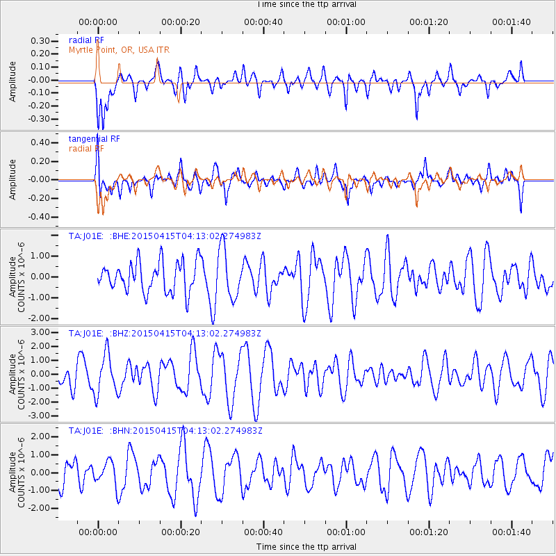
J01E Myrtle Point, OR, USA - Earthquake Result Viewer
*The percent match for this event was below the threshold and hence no stack was calculated.
| Earthquake location: |
Kermadec Islands Region |
| Earthquake latitude/longitude: |
-30.7/-179.9 |
| Earthquake time(UTC): |
2015/04/15 (105) 04:01:19 GMT |
| Earthquake Depth: |
400 km |
| Earthquake Magnitude: |
3.8 mb |
| Earthquake Catalog/Contributor: |
ISC/ISC |
|
| Network: |
TA USArray Transportable Network (new EarthScope stations) |
| Station: |
J01E Myrtle Point, OR, USA |
| Lat/Lon: |
43.16 N/123.93 W |
| Elevation: |
128 m |
|
| Distance: |
89.6 deg |
| Az: |
37.319 deg |
| Baz: |
225.519 deg |
| Ray Param: |
$rayparam |
*The percent match for this event was below the threshold and hence was not used in the summary stack. |
|
| Radial Match: |
63.078262 % |
| Radial Bump: |
400 |
| Transverse Match: |
58.27728 % |
| Transverse Bump: |
400 |
| SOD ConfigId: |
7422571 |
| Insert Time: |
2019-04-18 04:50:34.324 +0000 |
| GWidth: |
2.5 |
| Max Bumps: |
400 |
| Tol: |
0.001 |
|
Signal To Noise
| Channel | StoN | STA | LTA |
| TA:J01E: :BHZ:20150415T04:13:02.274983Z | 2.057269 | 1.4734477E-6 | 7.1621537E-7 |
| TA:J01E: :BHN:20150415T04:13:02.274983Z | 0.8581643 | 6.7707015E-7 | 7.88975E-7 |
| TA:J01E: :BHE:20150415T04:13:02.274983Z | 1.6883981 | 1.2030468E-6 | 7.125374E-7 |
| Arrivals |
| Ps | |
| PpPs | |
| PsPs/PpSs | |


