You are here: Home > Network List > TA - USArray Transportable Network (new EarthScope stations) Stations List
> Station E47A Iron Bridge, ON, CAN > Earthquake Result Viewer
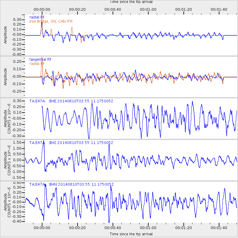
E47A Iron Bridge, ON, CAN - Earthquake Result Viewer
*The percent match for this event was below the threshold and hence no stack was calculated.
| Earthquake location: |
Hokkaido, Japan Region |
| Earthquake latitude/longitude: |
41.1/142.2 |
| Earthquake time(UTC): |
2014/08/10 (222) 03:43:16 GMT |
| Earthquake Depth: |
38 km |
| Earthquake Magnitude: |
6.0 MB |
| Earthquake Catalog/Contributor: |
NEIC PDE/NEIC COMCAT |
|
| Network: |
TA USArray Transportable Network (new EarthScope stations) |
| Station: |
E47A Iron Bridge, ON, CAN |
| Lat/Lon: |
46.45 N/83.28 W |
| Elevation: |
246 m |
|
| Distance: |
83.8 deg |
| Az: |
29.704 deg |
| Baz: |
327.225 deg |
| Ray Param: |
$rayparam |
*The percent match for this event was below the threshold and hence was not used in the summary stack. |
|
| Radial Match: |
67.72998 % |
| Radial Bump: |
289 |
| Transverse Match: |
58.640736 % |
| Transverse Bump: |
400 |
| SOD ConfigId: |
769524 |
| Insert Time: |
2014-08-24 04:48:18.474 +0000 |
| GWidth: |
2.5 |
| Max Bumps: |
400 |
| Tol: |
0.001 |
|
Signal To Noise
| Channel | StoN | STA | LTA |
| TA:E47A: :BHZ:20140810T03:55:11.175005Z | 6.209413 | 7.545387E-7 | 1.215153E-7 |
| TA:E47A: :BHN:20140810T03:55:11.175005Z | 1.8902534 | 2.0617522E-7 | 1.0907279E-7 |
| TA:E47A: :BHE:20140810T03:55:11.175005Z | 1.0049322 | 1.0380287E-7 | 1.0329342E-7 |
| Arrivals |
| Ps | |
| PpPs | |
| PsPs/PpSs | |


