You are here: Home > Network List > TA - USArray Transportable Network (new EarthScope stations) Stations List
> Station E62A Clayton Lake, ME, USA > Earthquake Result Viewer
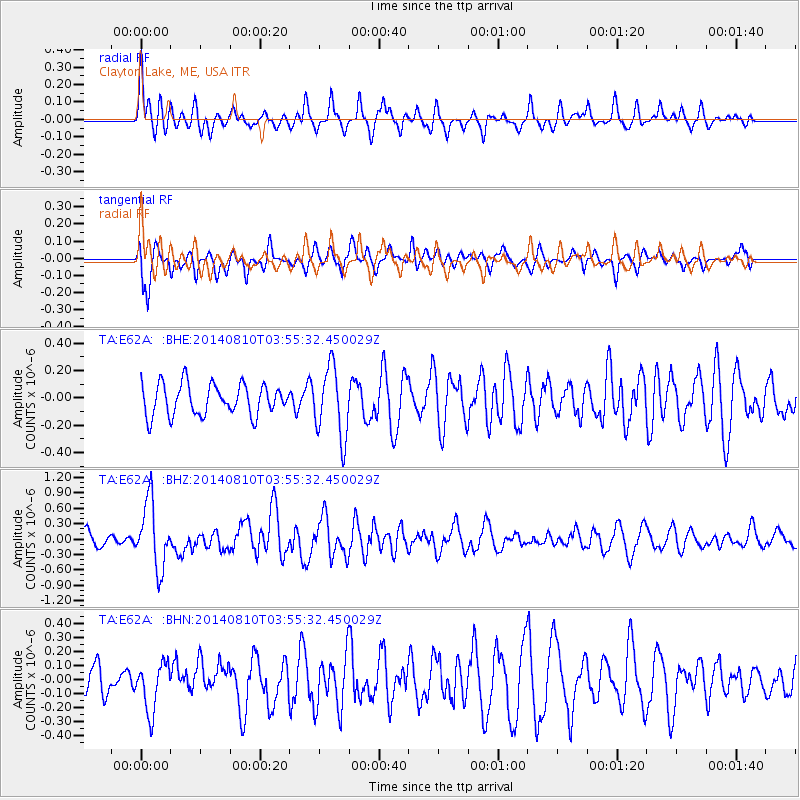
E62A Clayton Lake, ME, USA - Earthquake Result Viewer
*The percent match for this event was below the threshold and hence no stack was calculated.
| Earthquake location: |
Hokkaido, Japan Region |
| Earthquake latitude/longitude: |
41.1/142.2 |
| Earthquake time(UTC): |
2014/08/10 (222) 03:43:16 GMT |
| Earthquake Depth: |
38 km |
| Earthquake Magnitude: |
6.0 MB |
| Earthquake Catalog/Contributor: |
NEIC PDE/NEIC COMCAT |
|
| Network: |
TA USArray Transportable Network (new EarthScope stations) |
| Station: |
E62A Clayton Lake, ME, USA |
| Lat/Lon: |
46.62 N/69.52 W |
| Elevation: |
356 m |
|
| Distance: |
88.2 deg |
| Az: |
21.242 deg |
| Baz: |
336.61 deg |
| Ray Param: |
$rayparam |
*The percent match for this event was below the threshold and hence was not used in the summary stack. |
|
| Radial Match: |
73.26905 % |
| Radial Bump: |
400 |
| Transverse Match: |
69.722115 % |
| Transverse Bump: |
400 |
| SOD ConfigId: |
769524 |
| Insert Time: |
2014-08-24 04:49:12.527 +0000 |
| GWidth: |
2.5 |
| Max Bumps: |
400 |
| Tol: |
0.001 |
|
Signal To Noise
| Channel | StoN | STA | LTA |
| TA:E62A: :BHZ:20140810T03:55:32.450029Z | 4.665772 | 6.41898E-7 | 1.3757595E-7 |
| TA:E62A: :BHN:20140810T03:55:32.450029Z | 1.5368593 | 1.6985737E-7 | 1.1052239E-7 |
| TA:E62A: :BHE:20140810T03:55:32.450029Z | 2.2646234 | 2.565851E-7 | 1.13301446E-7 |
| Arrivals |
| Ps | |
| PpPs | |
| PsPs/PpSs | |


