You are here: Home > Network List > TA - USArray Transportable Network (new EarthScope stations) Stations List
> Station G59A Clarenceville, QC, USA > Earthquake Result Viewer
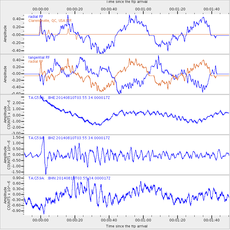
G59A Clarenceville, QC, USA - Earthquake Result Viewer
*The percent match for this event was below the threshold and hence no stack was calculated.
| Earthquake location: |
Hokkaido, Japan Region |
| Earthquake latitude/longitude: |
41.1/142.2 |
| Earthquake time(UTC): |
2014/08/10 (222) 03:43:16 GMT |
| Earthquake Depth: |
38 km |
| Earthquake Magnitude: |
6.0 MB |
| Earthquake Catalog/Contributor: |
NEIC PDE/NEIC COMCAT |
|
| Network: |
TA USArray Transportable Network (new EarthScope stations) |
| Station: |
G59A Clarenceville, QC, USA |
| Lat/Lon: |
45.08 N/73.18 W |
| Elevation: |
36 m |
|
| Distance: |
88.5 deg |
| Az: |
24.208 deg |
| Baz: |
334.079 deg |
| Ray Param: |
$rayparam |
*The percent match for this event was below the threshold and hence was not used in the summary stack. |
|
| Radial Match: |
48.00053 % |
| Radial Bump: |
400 |
| Transverse Match: |
12.120488 % |
| Transverse Bump: |
400 |
| SOD ConfigId: |
769524 |
| Insert Time: |
2014-08-24 04:50:40.513 +0000 |
| GWidth: |
2.5 |
| Max Bumps: |
400 |
| Tol: |
0.001 |
|
Signal To Noise
| Channel | StoN | STA | LTA |
| TA:G59A: :BHZ:20140810T03:55:34.000017Z | 5.068296 | 8.5160565E-7 | 1.6802603E-7 |
| TA:G59A: :BHN:20140810T03:55:34.000017Z | 2.6010842 | 8.081668E-7 | 3.1070383E-7 |
| TA:G59A: :BHE:20140810T03:55:34.000017Z | 2.4797707 | 2.3835023E-6 | 9.611786E-7 |
| Arrivals |
| Ps | |
| PpPs | |
| PsPs/PpSs | |


