You are here: Home > Network List > TA - USArray Transportable Network (new EarthScope stations) Stations List
> Station M51A Elyria, OH, USA > Earthquake Result Viewer
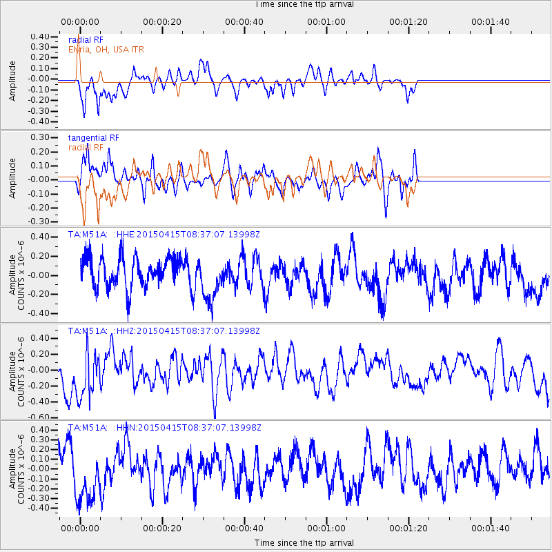
M51A Elyria, OH, USA - Earthquake Result Viewer
*The percent match for this event was below the threshold and hence no stack was calculated.
| Earthquake location: |
Cyprus Region |
| Earthquake latitude/longitude: |
34.9/32.3 |
| Earthquake time(UTC): |
2015/04/15 (105) 08:25:12 GMT |
| Earthquake Depth: |
10 km |
| Earthquake Magnitude: |
5.5 MB |
| Earthquake Catalog/Contributor: |
NEIC PDE/NEIC COMCAT |
|
| Network: |
TA USArray Transportable Network (new EarthScope stations) |
| Station: |
M51A Elyria, OH, USA |
| Lat/Lon: |
41.33 N/82.18 W |
| Elevation: |
239 m |
|
| Distance: |
83.2 deg |
| Az: |
316.361 deg |
| Baz: |
48.898 deg |
| Ray Param: |
$rayparam |
*The percent match for this event was below the threshold and hence was not used in the summary stack. |
|
| Radial Match: |
62.58964 % |
| Radial Bump: |
334 |
| Transverse Match: |
63.994762 % |
| Transverse Bump: |
357 |
| SOD ConfigId: |
7422571 |
| Insert Time: |
2019-04-18 05:02:46.495 +0000 |
| GWidth: |
2.5 |
| Max Bumps: |
400 |
| Tol: |
0.001 |
|
Signal To Noise
| Channel | StoN | STA | LTA |
| TA:M51A: :HHZ:20150415T08:37:07.13998Z | 1.2479731 | 3.0170835E-7 | 2.417587E-7 |
| TA:M51A: :HHN:20150415T08:37:07.13998Z | 1.4845086 | 3.181574E-7 | 2.1431832E-7 |
| TA:M51A: :HHE:20150415T08:37:07.13998Z | 1.5850836 | 2.4140857E-7 | 1.5230022E-7 |
| Arrivals |
| Ps | |
| PpPs | |
| PsPs/PpSs | |


