You are here: Home > Network List > TA - USArray Transportable Network (new EarthScope stations) Stations List
> Station R56A Bull Pasture Mountain, McDowell, VA, USA > Earthquake Result Viewer
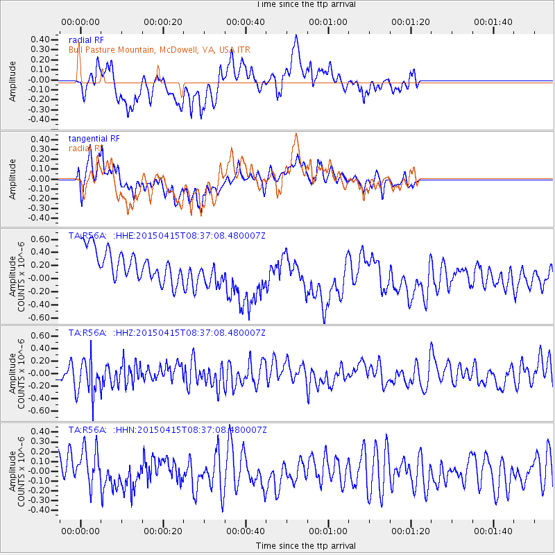
R56A Bull Pasture Mountain, McDowell, VA, USA - Earthquake Result Viewer
*The percent match for this event was below the threshold and hence no stack was calculated.
| Earthquake location: |
Cyprus Region |
| Earthquake latitude/longitude: |
34.9/32.3 |
| Earthquake time(UTC): |
2015/04/15 (105) 08:25:12 GMT |
| Earthquake Depth: |
10 km |
| Earthquake Magnitude: |
5.5 MB |
| Earthquake Catalog/Contributor: |
NEIC PDE/NEIC COMCAT |
|
| Network: |
TA USArray Transportable Network (new EarthScope stations) |
| Station: |
R56A Bull Pasture Mountain, McDowell, VA, USA |
| Lat/Lon: |
38.41 N/79.40 W |
| Elevation: |
902 m |
|
| Distance: |
83.5 deg |
| Az: |
312.726 deg |
| Baz: |
50.255 deg |
| Ray Param: |
$rayparam |
*The percent match for this event was below the threshold and hence was not used in the summary stack. |
|
| Radial Match: |
61.81225 % |
| Radial Bump: |
400 |
| Transverse Match: |
47.35173 % |
| Transverse Bump: |
400 |
| SOD ConfigId: |
7422571 |
| Insert Time: |
2019-04-18 05:02:59.867 +0000 |
| GWidth: |
2.5 |
| Max Bumps: |
400 |
| Tol: |
0.001 |
|
Signal To Noise
| Channel | StoN | STA | LTA |
| TA:R56A: :HHZ:20150415T08:37:08.480007Z | 1.6025716 | 2.8754798E-7 | 1.794291E-7 |
| TA:R56A: :HHN:20150415T08:37:08.480007Z | 1.3177407 | 1.8898024E-7 | 1.4341231E-7 |
| TA:R56A: :HHE:20150415T08:37:08.480007Z | 1.0248021 | 2.351298E-7 | 2.2943924E-7 |
| Arrivals |
| Ps | |
| PpPs | |
| PsPs/PpSs | |


