You are here: Home > Network List > TA - USArray Transportable Network (new EarthScope stations) Stations List
> Station T56A Rocky Mt, VA, USA > Earthquake Result Viewer
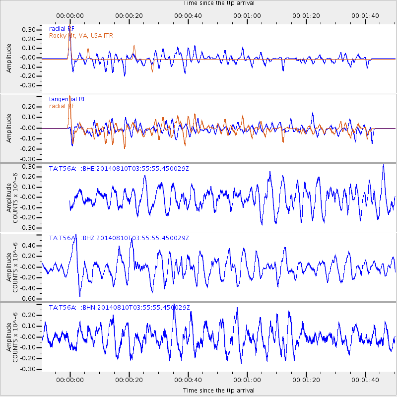
T56A Rocky Mt, VA, USA - Earthquake Result Viewer
*The percent match for this event was below the threshold and hence no stack was calculated.
| Earthquake location: |
Hokkaido, Japan Region |
| Earthquake latitude/longitude: |
41.1/142.2 |
| Earthquake time(UTC): |
2014/08/10 (222) 03:43:16 GMT |
| Earthquake Depth: |
38 km |
| Earthquake Magnitude: |
6.0 MB |
| Earthquake Catalog/Contributor: |
NEIC PDE/NEIC COMCAT |
|
| Network: |
TA USArray Transportable Network (new EarthScope stations) |
| Station: |
T56A Rocky Mt, VA, USA |
| Lat/Lon: |
37.03 N/80.03 W |
| Elevation: |
387 m |
|
| Distance: |
93.1 deg |
| Az: |
32.573 deg |
| Baz: |
329.462 deg |
| Ray Param: |
$rayparam |
*The percent match for this event was below the threshold and hence was not used in the summary stack. |
|
| Radial Match: |
78.247665 % |
| Radial Bump: |
400 |
| Transverse Match: |
62.22603 % |
| Transverse Bump: |
400 |
| SOD ConfigId: |
769524 |
| Insert Time: |
2014-08-24 05:02:27.166 +0000 |
| GWidth: |
2.5 |
| Max Bumps: |
400 |
| Tol: |
0.001 |
|
Signal To Noise
| Channel | StoN | STA | LTA |
| TA:T56A: :BHZ:20140810T03:55:55.450029Z | 2.630065 | 3.379944E-7 | 1.285118E-7 |
| TA:T56A: :BHN:20140810T03:55:55.450029Z | 0.8314133 | 7.4261855E-8 | 8.9320025E-8 |
| TA:T56A: :BHE:20140810T03:55:55.450029Z | 1.7793132 | 1.1431694E-7 | 6.424779E-8 |
| Arrivals |
| Ps | |
| PpPs | |
| PsPs/PpSs | |


