You are here: Home > Network List > TA - USArray Transportable Network (new EarthScope stations) Stations List
> Station X43A Marvell, AR, USA > Earthquake Result Viewer
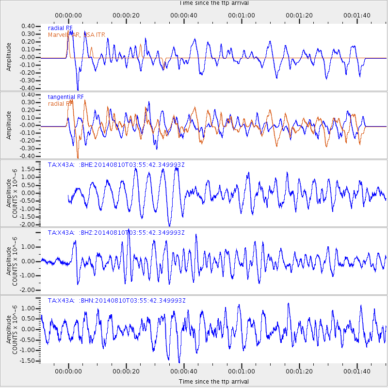
X43A Marvell, AR, USA - Earthquake Result Viewer
*The percent match for this event was below the threshold and hence no stack was calculated.
| Earthquake location: |
Hokkaido, Japan Region |
| Earthquake latitude/longitude: |
41.1/142.2 |
| Earthquake time(UTC): |
2014/08/10 (222) 03:43:16 GMT |
| Earthquake Depth: |
38 km |
| Earthquake Magnitude: |
6.0 MB |
| Earthquake Catalog/Contributor: |
NEIC PDE/NEIC COMCAT |
|
| Network: |
TA USArray Transportable Network (new EarthScope stations) |
| Station: |
X43A Marvell, AR, USA |
| Lat/Lon: |
34.52 N/90.88 W |
| Elevation: |
53 m |
|
| Distance: |
90.3 deg |
| Az: |
41.292 deg |
| Baz: |
322.872 deg |
| Ray Param: |
$rayparam |
*The percent match for this event was below the threshold and hence was not used in the summary stack. |
|
| Radial Match: |
54.256718 % |
| Radial Bump: |
400 |
| Transverse Match: |
47.8348 % |
| Transverse Bump: |
400 |
| SOD ConfigId: |
769524 |
| Insert Time: |
2014-08-24 05:05:02.803 +0000 |
| GWidth: |
2.5 |
| Max Bumps: |
400 |
| Tol: |
0.001 |
|
Signal To Noise
| Channel | StoN | STA | LTA |
| TA:X43A: :BHZ:20140810T03:55:42.349993Z | 4.0565157 | 8.132929E-7 | 2.004905E-7 |
| TA:X43A: :BHN:20140810T03:55:42.349993Z | 0.56828284 | 3.558741E-7 | 6.262271E-7 |
| TA:X43A: :BHE:20140810T03:55:42.349993Z | 1.6420096 | 1.0262904E-6 | 6.2502096E-7 |
| Arrivals |
| Ps | |
| PpPs | |
| PsPs/PpSs | |


