You are here: Home > Network List > US - United States National Seismic Network Stations List
> Station MSO Missoula, Montana, USA > Earthquake Result Viewer
MSO Missoula, Montana, USA - Earthquake Result Viewer
*The percent match for this event was below the threshold and hence no stack was calculated.
| Earthquake location: |
Hokkaido, Japan Region |
| Earthquake latitude/longitude: |
41.1/142.2 |
| Earthquake time(UTC): |
2014/08/10 (222) 03:43:16 GMT |
| Earthquake Depth: |
38 km |
| Earthquake Magnitude: |
6.0 MB |
| Earthquake Catalog/Contributor: |
NEIC PDE/NEIC COMCAT |
|
| Network: |
US United States National Seismic Network |
| Station: |
MSO Missoula, Montana, USA |
| Lat/Lon: |
46.83 N/113.94 W |
| Elevation: |
1264 m |
|
| Distance: |
69.4 deg |
| Az: |
45.408 deg |
| Baz: |
308.434 deg |
| Ray Param: |
$rayparam |
*The percent match for this event was below the threshold and hence was not used in the summary stack. |
|
| Radial Match: |
77.21861 % |
| Radial Bump: |
400 |
| Transverse Match: |
69.6876 % |
| Transverse Bump: |
400 |
| SOD ConfigId: |
769524 |
| Insert Time: |
2014-08-24 05:09:29.930 +0000 |
| GWidth: |
2.5 |
| Max Bumps: |
400 |
| Tol: |
0.001 |
|
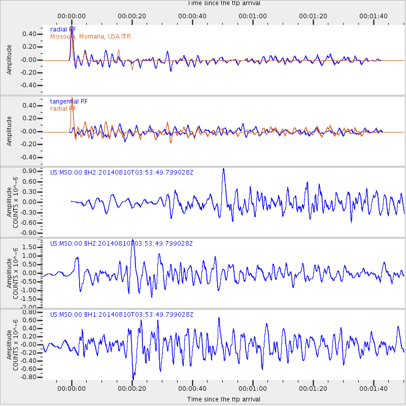
Signal To Noise
| Channel | StoN | STA | LTA |
| US:MSO:00:BHZ:20140810T03:53:49.799028Z | 6.894801 | 5.63133E-7 | 8.1675026E-8 |
| US:MSO:00:BH1:20140810T03:53:49.799028Z | 2.6770828 | 1.5671158E-7 | 5.853819E-8 |
| US:MSO:00:BH2:20140810T03:53:49.799028Z | 2.04235 | 2.1456825E-7 | 1.05059485E-7 |
| Arrivals |
| Ps | |
| PpPs | |
| PsPs/PpSs | |


