You are here: Home > Network List > AV - Alaska Volcano Observatory Stations List
> Station MAPS Pakushin Southeast, Makushin Volcano, Alaska > Earthquake Result Viewer
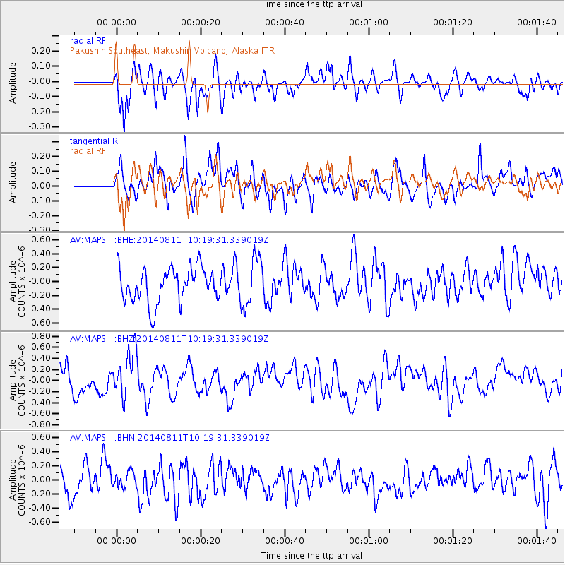
MAPS Pakushin Southeast, Makushin Volcano, Alaska - Earthquake Result Viewer
*The percent match for this event was below the threshold and hence no stack was calculated.
| Earthquake location: |
Kermadec Islands Region |
| Earthquake latitude/longitude: |
-29.7/-176.1 |
| Earthquake time(UTC): |
2014/08/11 (223) 10:07:37 GMT |
| Earthquake Depth: |
32 km |
| Earthquake Magnitude: |
5.5 MB |
| Earthquake Catalog/Contributor: |
NEIC PDE/NEIC COMCAT |
|
| Network: |
AV Alaska Volcano Observatory |
| Station: |
MAPS Pakushin Southeast, Makushin Volcano, Alaska |
| Lat/Lon: |
53.81 N/166.94 W |
| Elevation: |
333 m |
|
| Distance: |
83.6 deg |
| Az: |
5.436 deg |
| Baz: |
187.984 deg |
| Ray Param: |
$rayparam |
*The percent match for this event was below the threshold and hence was not used in the summary stack. |
|
| Radial Match: |
51.828728 % |
| Radial Bump: |
400 |
| Transverse Match: |
54.400356 % |
| Transverse Bump: |
400 |
| SOD ConfigId: |
769524 |
| Insert Time: |
2014-08-25 10:14:24.987 +0000 |
| GWidth: |
2.5 |
| Max Bumps: |
400 |
| Tol: |
0.001 |
|
Signal To Noise
| Channel | StoN | STA | LTA |
| AV:MAPS: :BHZ:20140811T10:19:31.339019Z | 2.0372515 | 4.2578645E-7 | 2.0900043E-7 |
| AV:MAPS: :BHN:20140811T10:19:31.339019Z | 0.42147774 | 1.09102025E-7 | 2.5885598E-7 |
| AV:MAPS: :BHE:20140811T10:19:31.339019Z | 1.4190335 | 3.4892903E-7 | 2.4589204E-7 |
| Arrivals |
| Ps | |
| PpPs | |
| PsPs/PpSs | |


