You are here: Home > Network List > TA - USArray Transportable Network (new EarthScope stations) Stations List
> Station 121A Cookes Peak, Deming, NM, USA > Earthquake Result Viewer
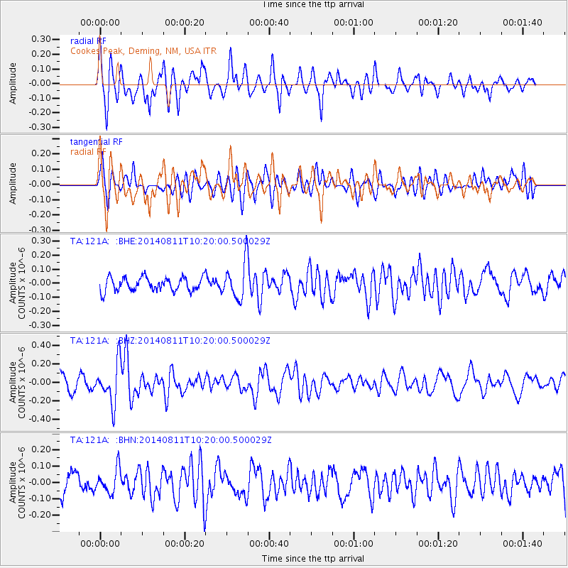
121A Cookes Peak, Deming, NM, USA - Earthquake Result Viewer
*The percent match for this event was below the threshold and hence no stack was calculated.
| Earthquake location: |
Kermadec Islands Region |
| Earthquake latitude/longitude: |
-29.7/-176.1 |
| Earthquake time(UTC): |
2014/08/11 (223) 10:07:37 GMT |
| Earthquake Depth: |
32 km |
| Earthquake Magnitude: |
5.5 MB |
| Earthquake Catalog/Contributor: |
NEIC PDE/NEIC COMCAT |
|
| Network: |
TA USArray Transportable Network (new EarthScope stations) |
| Station: |
121A Cookes Peak, Deming, NM, USA |
| Lat/Lon: |
32.53 N/107.79 W |
| Elevation: |
1652 m |
|
| Distance: |
89.6 deg |
| Az: |
51.704 deg |
| Baz: |
233.898 deg |
| Ray Param: |
$rayparam |
*The percent match for this event was below the threshold and hence was not used in the summary stack. |
|
| Radial Match: |
72.33878 % |
| Radial Bump: |
385 |
| Transverse Match: |
53.928387 % |
| Transverse Bump: |
400 |
| SOD ConfigId: |
769524 |
| Insert Time: |
2014-08-25 10:26:07.787 +0000 |
| GWidth: |
2.5 |
| Max Bumps: |
400 |
| Tol: |
0.001 |
|
Signal To Noise
| Channel | StoN | STA | LTA |
| TA:121A: :BHZ:20140811T10:20:00.500029Z | 2.7368114 | 2.2742344E-7 | 8.309796E-8 |
| TA:121A: :BHN:20140811T10:20:00.500029Z | 1.0397235 | 7.53177E-8 | 7.244012E-8 |
| TA:121A: :BHE:20140811T10:20:00.500029Z | 2.7965748 | 1.3334343E-7 | 4.7680984E-8 |
| Arrivals |
| Ps | |
| PpPs | |
| PsPs/PpSs | |


