You are here: Home > Network List > TA - USArray Transportable Network (new EarthScope stations) Stations List
> Station A04D Lummi Island, WA, USA > Earthquake Result Viewer
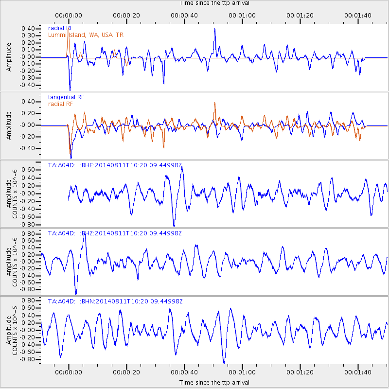
A04D Lummi Island, WA, USA - Earthquake Result Viewer
*The percent match for this event was below the threshold and hence no stack was calculated.
| Earthquake location: |
Kermadec Islands Region |
| Earthquake latitude/longitude: |
-29.7/-176.1 |
| Earthquake time(UTC): |
2014/08/11 (223) 10:07:37 GMT |
| Earthquake Depth: |
32 km |
| Earthquake Magnitude: |
5.5 MB |
| Earthquake Catalog/Contributor: |
NEIC PDE/NEIC COMCAT |
|
| Network: |
TA USArray Transportable Network (new EarthScope stations) |
| Station: |
A04D Lummi Island, WA, USA |
| Lat/Lon: |
48.72 N/122.71 W |
| Elevation: |
13 m |
|
| Distance: |
91.5 deg |
| Az: |
32.115 deg |
| Baz: |
224.275 deg |
| Ray Param: |
$rayparam |
*The percent match for this event was below the threshold and hence was not used in the summary stack. |
|
| Radial Match: |
61.76005 % |
| Radial Bump: |
400 |
| Transverse Match: |
48.59326 % |
| Transverse Bump: |
400 |
| SOD ConfigId: |
769524 |
| Insert Time: |
2014-08-25 10:26:17.768 +0000 |
| GWidth: |
2.5 |
| Max Bumps: |
400 |
| Tol: |
0.001 |
|
Signal To Noise
| Channel | StoN | STA | LTA |
| TA:A04D: :BHZ:20140811T10:20:09.44998Z | 1.9306768 | 4.003963E-7 | 2.0738649E-7 |
| TA:A04D: :BHN:20140811T10:20:09.44998Z | 1.025968 | 2.421434E-7 | 2.3601459E-7 |
| TA:A04D: :BHE:20140811T10:20:09.44998Z | 1.6736683 | 2.6253983E-7 | 1.5686493E-7 |
| Arrivals |
| Ps | |
| PpPs | |
| PsPs/PpSs | |


