You are here: Home > Network List > TA - USArray Transportable Network (new EarthScope stations) Stations List
> Station O03E Paynes Creek, CA, USA > Earthquake Result Viewer
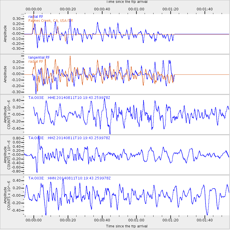
O03E Paynes Creek, CA, USA - Earthquake Result Viewer
*The percent match for this event was below the threshold and hence no stack was calculated.
| Earthquake location: |
Kermadec Islands Region |
| Earthquake latitude/longitude: |
-29.7/-176.1 |
| Earthquake time(UTC): |
2014/08/11 (223) 10:07:37 GMT |
| Earthquake Depth: |
32 km |
| Earthquake Magnitude: |
5.5 MB |
| Earthquake Catalog/Contributor: |
NEIC PDE/NEIC COMCAT |
|
| Network: |
TA USArray Transportable Network (new EarthScope stations) |
| Station: |
O03E Paynes Creek, CA, USA |
| Lat/Lon: |
40.29 N/121.80 W |
| Elevation: |
967 m |
|
| Distance: |
86.0 deg |
| Az: |
38.496 deg |
| Baz: |
225.05 deg |
| Ray Param: |
$rayparam |
*The percent match for this event was below the threshold and hence was not used in the summary stack. |
|
| Radial Match: |
51.04948 % |
| Radial Bump: |
348 |
| Transverse Match: |
64.60427 % |
| Transverse Bump: |
390 |
| SOD ConfigId: |
769524 |
| Insert Time: |
2014-08-25 10:27:11.427 +0000 |
| GWidth: |
2.5 |
| Max Bumps: |
400 |
| Tol: |
0.001 |
|
Signal To Noise
| Channel | StoN | STA | LTA |
| TA:O03E: :HHZ:20140811T10:19:43.259978Z | 4.1915183 | 4.406607E-7 | 1.0513152E-7 |
| TA:O03E: :HHN:20140811T10:19:43.259978Z | 0.8872524 | 1.3305163E-7 | 1.4995918E-7 |
| TA:O03E: :HHE:20140811T10:19:43.259978Z | 1.4151934 | 2.1825939E-7 | 1.5422583E-7 |
| Arrivals |
| Ps | |
| PpPs | |
| PsPs/PpSs | |


