You are here: Home > Network List > TA - USArray Transportable Network (new EarthScope stations) Stations List
> Station R11A Troy Canyon, Currant, NV, USA > Earthquake Result Viewer
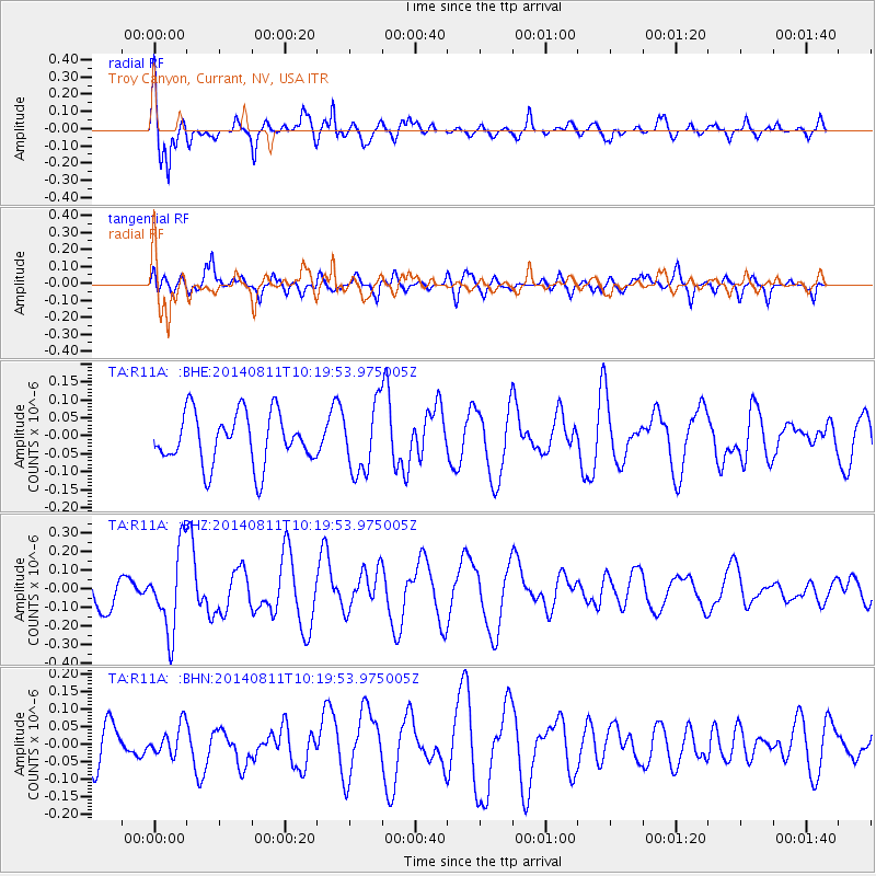
R11A Troy Canyon, Currant, NV, USA - Earthquake Result Viewer
*The percent match for this event was below the threshold and hence no stack was calculated.
| Earthquake location: |
Kermadec Islands Region |
| Earthquake latitude/longitude: |
-29.7/-176.1 |
| Earthquake time(UTC): |
2014/08/11 (223) 10:07:37 GMT |
| Earthquake Depth: |
32 km |
| Earthquake Magnitude: |
5.5 MB |
| Earthquake Catalog/Contributor: |
NEIC PDE/NEIC COMCAT |
|
| Network: |
TA USArray Transportable Network (new EarthScope stations) |
| Station: |
R11A Troy Canyon, Currant, NV, USA |
| Lat/Lon: |
38.35 N/115.59 W |
| Elevation: |
1756 m |
|
| Distance: |
88.2 deg |
| Az: |
43.204 deg |
| Baz: |
229.217 deg |
| Ray Param: |
$rayparam |
*The percent match for this event was below the threshold and hence was not used in the summary stack. |
|
| Radial Match: |
71.735535 % |
| Radial Bump: |
351 |
| Transverse Match: |
43.659428 % |
| Transverse Bump: |
400 |
| SOD ConfigId: |
769524 |
| Insert Time: |
2014-08-25 10:27:21.139 +0000 |
| GWidth: |
2.5 |
| Max Bumps: |
400 |
| Tol: |
0.001 |
|
Signal To Noise
| Channel | StoN | STA | LTA |
| TA:R11A: :BHZ:20140811T10:19:53.975005Z | 2.430153 | 2.188754E-7 | 9.0066514E-8 |
| TA:R11A: :BHN:20140811T10:19:53.975005Z | 0.6100298 | 4.2051077E-8 | 6.893283E-8 |
| TA:R11A: :BHE:20140811T10:19:53.975005Z | 1.3082808 | 9.3190245E-8 | 7.123107E-8 |
| Arrivals |
| Ps | |
| PpPs | |
| PsPs/PpSs | |


