You are here: Home > Network List > UW - Pacific Northwest Regional Seismic Network Stations List
> Station UMAT Pilot Rock, OR, USA > Earthquake Result Viewer
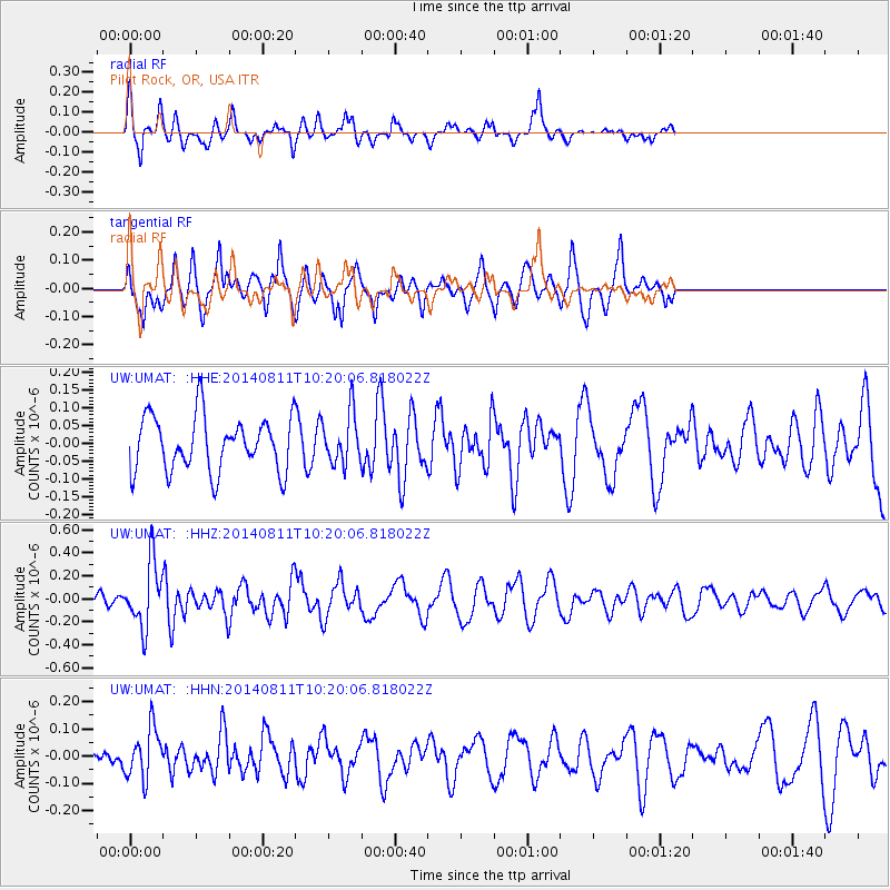
UMAT Pilot Rock, OR, USA - Earthquake Result Viewer
*The percent match for this event was below the threshold and hence no stack was calculated.
| Earthquake location: |
Kermadec Islands Region |
| Earthquake latitude/longitude: |
-29.7/-176.1 |
| Earthquake time(UTC): |
2014/08/11 (223) 10:07:37 GMT |
| Earthquake Depth: |
32 km |
| Earthquake Magnitude: |
5.5 MB |
| Earthquake Catalog/Contributor: |
NEIC PDE/NEIC COMCAT |
|
| Network: |
UW Pacific Northwest Regional Seismic Network |
| Station: |
UMAT Pilot Rock, OR, USA |
| Lat/Lon: |
45.29 N/118.96 W |
| Elevation: |
1318 m |
|
| Distance: |
90.9 deg |
| Az: |
36.36 deg |
| Baz: |
226.918 deg |
| Ray Param: |
$rayparam |
*The percent match for this event was below the threshold and hence was not used in the summary stack. |
|
| Radial Match: |
59.996693 % |
| Radial Bump: |
261 |
| Transverse Match: |
57.05578 % |
| Transverse Bump: |
394 |
| SOD ConfigId: |
769524 |
| Insert Time: |
2014-08-25 10:31:55.086 +0000 |
| GWidth: |
2.5 |
| Max Bumps: |
400 |
| Tol: |
0.001 |
|
Signal To Noise
| Channel | StoN | STA | LTA |
| UW:UMAT: :HHZ:20140811T10:20:06.818022Z | 2.9372928 | 2.7895322E-7 | 9.4969494E-8 |
| UW:UMAT: :HHN:20140811T10:20:06.818022Z | 1.319114 | 9.125216E-8 | 6.917686E-8 |
| UW:UMAT: :HHE:20140811T10:20:06.818022Z | 0.92599255 | 7.1020445E-8 | 7.6696566E-8 |
| Arrivals |
| Ps | |
| PpPs | |
| PsPs/PpSs | |


