You are here: Home > Network List > AK - Alaska Regional Network Stations List
> Station CUT Chulitna, AK, USA > Earthquake Result Viewer
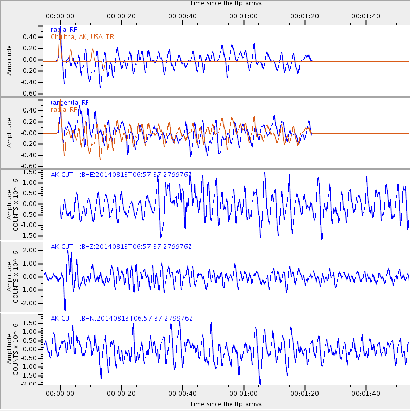
CUT Chulitna, AK, USA - Earthquake Result Viewer
*The percent match for this event was below the threshold and hence no stack was calculated.
| Earthquake location: |
Near Coast Of Guerrero, Mexico |
| Earthquake latitude/longitude: |
16.3/-98.2 |
| Earthquake time(UTC): |
2014/08/13 (225) 06:48:11 GMT |
| Earthquake Depth: |
10 km |
| Earthquake Magnitude: |
5.8 MWP |
| Earthquake Catalog/Contributor: |
NEIC PDE/NEIC COMCAT |
|
| Network: |
AK Alaska Regional Network |
| Station: |
CUT Chulitna, AK, USA |
| Lat/Lon: |
62.41 N/150.26 W |
| Elevation: |
574 m |
|
| Distance: |
58.5 deg |
| Az: |
334.481 deg |
| Baz: |
117.346 deg |
| Ray Param: |
$rayparam |
*The percent match for this event was below the threshold and hence was not used in the summary stack. |
|
| Radial Match: |
59.59592 % |
| Radial Bump: |
400 |
| Transverse Match: |
48.85842 % |
| Transverse Bump: |
400 |
| SOD ConfigId: |
769524 |
| Insert Time: |
2014-08-27 07:09:07.763 +0000 |
| GWidth: |
2.5 |
| Max Bumps: |
400 |
| Tol: |
0.001 |
|
Signal To Noise
| Channel | StoN | STA | LTA |
| AK:CUT: :BHZ:20140813T06:57:37.279976Z | 6.639903 | 1.0897768E-6 | 1.6412541E-7 |
| AK:CUT: :BHN:20140813T06:57:37.279976Z | 2.250918 | 7.3913094E-7 | 3.2836869E-7 |
| AK:CUT: :BHE:20140813T06:57:37.279976Z | 2.0570683 | 7.783902E-7 | 3.7839783E-7 |
| Arrivals |
| Ps | |
| PpPs | |
| PsPs/PpSs | |


