You are here: Home > Network List > CN - Canadian National Seismograph Network Stations List
> Station INK INUVIK, NT > Earthquake Result Viewer
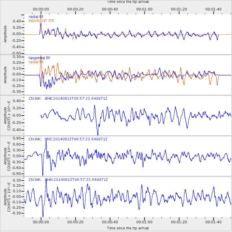
INK INUVIK, NT - Earthquake Result Viewer
*The percent match for this event was below the threshold and hence no stack was calculated.
| Earthquake location: |
Near Coast Of Guerrero, Mexico |
| Earthquake latitude/longitude: |
16.3/-98.2 |
| Earthquake time(UTC): |
2014/08/13 (225) 06:48:11 GMT |
| Earthquake Depth: |
10 km |
| Earthquake Magnitude: |
5.8 MWP |
| Earthquake Catalog/Contributor: |
NEIC PDE/NEIC COMCAT |
|
| Network: |
CN Canadian National Seismograph Network |
| Station: |
INK INUVIK, NT |
| Lat/Lon: |
68.31 N/133.53 W |
| Elevation: |
44 m |
|
| Distance: |
56.6 deg |
| Az: |
345.063 deg |
| Baz: |
138.269 deg |
| Ray Param: |
$rayparam |
*The percent match for this event was below the threshold and hence was not used in the summary stack. |
|
| Radial Match: |
64.80262 % |
| Radial Bump: |
400 |
| Transverse Match: |
65.3407 % |
| Transverse Bump: |
400 |
| SOD ConfigId: |
769524 |
| Insert Time: |
2014-08-27 07:14:17.352 +0000 |
| GWidth: |
2.5 |
| Max Bumps: |
400 |
| Tol: |
0.001 |
|
Signal To Noise
| Channel | StoN | STA | LTA |
| CN:INK: :BHZ:20140813T06:57:23.649971Z | 3.5869615 | 3.9021012E-7 | 1.087857E-7 |
| CN:INK: :BHN:20140813T06:57:23.649971Z | 2.3675385 | 1.5823166E-7 | 6.683383E-8 |
| CN:INK: :BHE:20140813T06:57:23.649971Z | 2.6209652 | 2.4870835E-7 | 9.4891895E-8 |
| Arrivals |
| Ps | |
| PpPs | |
| PsPs/PpSs | |


