You are here: Home > Network List > LD - Lamont-Doherty Cooperative Seismographic Network Stations List
> Station MVL Millersville University, PA > Earthquake Result Viewer
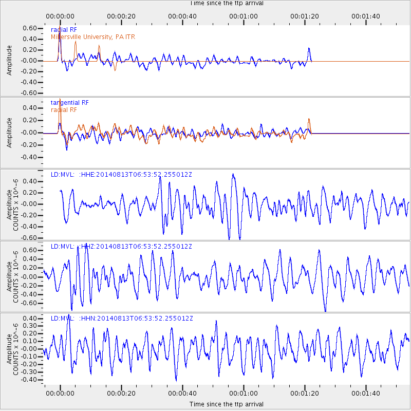
MVL Millersville University, PA - Earthquake Result Viewer
*The percent match for this event was below the threshold and hence no stack was calculated.
| Earthquake location: |
Near Coast Of Guerrero, Mexico |
| Earthquake latitude/longitude: |
16.3/-98.2 |
| Earthquake time(UTC): |
2014/08/13 (225) 06:48:11 GMT |
| Earthquake Depth: |
10 km |
| Earthquake Magnitude: |
5.8 MWP |
| Earthquake Catalog/Contributor: |
NEIC PDE/NEIC COMCAT |
|
| Network: |
LD Lamont-Doherty Cooperative Seismographic Network |
| Station: |
MVL Millersville University, PA |
| Lat/Lon: |
40.00 N/76.35 W |
| Elevation: |
91 m |
|
| Distance: |
30.3 deg |
| Az: |
34.507 deg |
| Baz: |
225.076 deg |
| Ray Param: |
$rayparam |
*The percent match for this event was below the threshold and hence was not used in the summary stack. |
|
| Radial Match: |
71.95148 % |
| Radial Bump: |
400 |
| Transverse Match: |
56.53945 % |
| Transverse Bump: |
400 |
| SOD ConfigId: |
769524 |
| Insert Time: |
2014-08-27 07:22:19.106 +0000 |
| GWidth: |
2.5 |
| Max Bumps: |
400 |
| Tol: |
0.001 |
|
Signal To Noise
| Channel | StoN | STA | LTA |
| LD:MVL: :HHZ:20140813T06:53:52.255012Z | 3.454531 | 3.1297006E-7 | 9.059698E-8 |
| LD:MVL: :HHN:20140813T06:53:52.255012Z | 1.8334376 | 2.1418451E-7 | 1.1682127E-7 |
| LD:MVL: :HHE:20140813T06:53:52.255012Z | 1.9333255 | 2.4513776E-7 | 1.2679591E-7 |
| Arrivals |
| Ps | |
| PpPs | |
| PsPs/PpSs | |


