You are here: Home > Network List > TA - USArray Transportable Network (new EarthScope stations) Stations List
> Station J62A Henniker, NH, USA > Earthquake Result Viewer
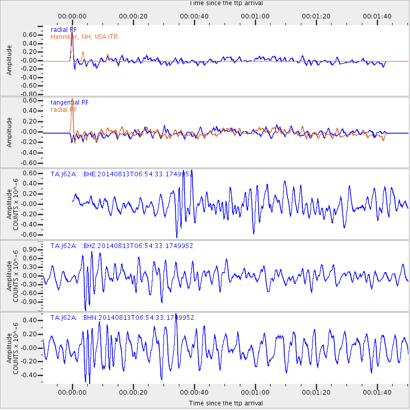
J62A Henniker, NH, USA - Earthquake Result Viewer
*The percent match for this event was below the threshold and hence no stack was calculated.
| Earthquake location: |
Near Coast Of Guerrero, Mexico |
| Earthquake latitude/longitude: |
16.3/-98.2 |
| Earthquake time(UTC): |
2014/08/13 (225) 06:48:11 GMT |
| Earthquake Depth: |
10 km |
| Earthquake Magnitude: |
5.8 MWP |
| Earthquake Catalog/Contributor: |
NEIC PDE/NEIC COMCAT |
|
| Network: |
TA USArray Transportable Network (new EarthScope stations) |
| Station: |
J62A Henniker, NH, USA |
| Lat/Lon: |
43.23 N/71.81 W |
| Elevation: |
266 m |
|
| Distance: |
34.9 deg |
| Az: |
34.504 deg |
| Baz: |
228.079 deg |
| Ray Param: |
$rayparam |
*The percent match for this event was below the threshold and hence was not used in the summary stack. |
|
| Radial Match: |
70.77161 % |
| Radial Bump: |
400 |
| Transverse Match: |
55.966343 % |
| Transverse Bump: |
400 |
| SOD ConfigId: |
769524 |
| Insert Time: |
2014-08-27 07:41:43.513 +0000 |
| GWidth: |
2.5 |
| Max Bumps: |
400 |
| Tol: |
0.001 |
|
Signal To Noise
| Channel | StoN | STA | LTA |
| TA:J62A: :BHZ:20140813T06:54:33.174995Z | 2.7201827 | 4.1624216E-7 | 1.5301994E-7 |
| TA:J62A: :BHN:20140813T06:54:33.174995Z | 1.6178988 | 1.7971924E-7 | 1.1108188E-7 |
| TA:J62A: :BHE:20140813T06:54:33.174995Z | 2.5517318 | 2.363851E-7 | 9.263713E-8 |
| Arrivals |
| Ps | |
| PpPs | |
| PsPs/PpSs | |


