You are here: Home > Network List > TA - USArray Transportable Network (new EarthScope stations) Stations List
> Station MDND Maddock, ND, USA > Earthquake Result Viewer
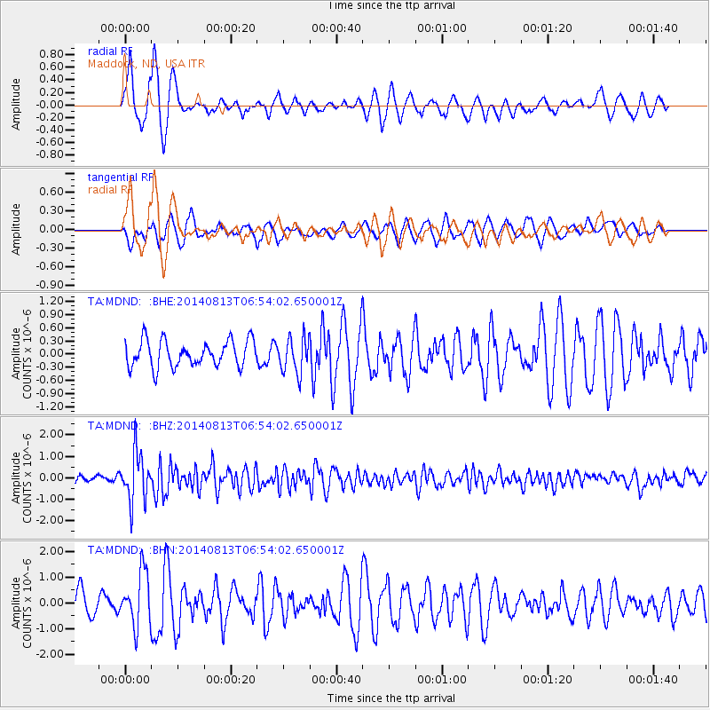
MDND Maddock, ND, USA - Earthquake Result Viewer
*The percent match for this event was below the threshold and hence no stack was calculated.
| Earthquake location: |
Near Coast Of Guerrero, Mexico |
| Earthquake latitude/longitude: |
16.3/-98.2 |
| Earthquake time(UTC): |
2014/08/13 (225) 06:48:11 GMT |
| Earthquake Depth: |
10 km |
| Earthquake Magnitude: |
5.8 MWP |
| Earthquake Catalog/Contributor: |
NEIC PDE/NEIC COMCAT |
|
| Network: |
TA USArray Transportable Network (new EarthScope stations) |
| Station: |
MDND Maddock, ND, USA |
| Lat/Lon: |
47.85 N/99.60 W |
| Elevation: |
479 m |
|
| Distance: |
31.4 deg |
| Az: |
358.146 deg |
| Baz: |
177.356 deg |
| Ray Param: |
$rayparam |
*The percent match for this event was below the threshold and hence was not used in the summary stack. |
|
| Radial Match: |
77.43136 % |
| Radial Bump: |
355 |
| Transverse Match: |
68.586395 % |
| Transverse Bump: |
400 |
| SOD ConfigId: |
769524 |
| Insert Time: |
2014-08-27 07:44:08.971 +0000 |
| GWidth: |
2.5 |
| Max Bumps: |
400 |
| Tol: |
0.001 |
|
Signal To Noise
| Channel | StoN | STA | LTA |
| TA:MDND: :BHZ:20140813T06:54:02.650001Z | 7.3127375 | 1.1398586E-6 | 1.5587304E-7 |
| TA:MDND: :BHN:20140813T06:54:02.650001Z | 2.3800495 | 1.0585555E-6 | 4.4476195E-7 |
| TA:MDND: :BHE:20140813T06:54:02.650001Z | 1.3511652 | 4.0600602E-7 | 3.0048585E-7 |
| Arrivals |
| Ps | |
| PpPs | |
| PsPs/PpSs | |


