You are here: Home > Network List > US - United States National Seismic Network Stations List
> Station EGMT Eagleton, Montana, USA > Earthquake Result Viewer
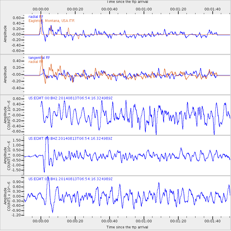
EGMT Eagleton, Montana, USA - Earthquake Result Viewer
*The percent match for this event was below the threshold and hence no stack was calculated.
| Earthquake location: |
Near Coast Of Guerrero, Mexico |
| Earthquake latitude/longitude: |
16.3/-98.2 |
| Earthquake time(UTC): |
2014/08/13 (225) 06:48:11 GMT |
| Earthquake Depth: |
10 km |
| Earthquake Magnitude: |
5.8 MWP |
| Earthquake Catalog/Contributor: |
NEIC PDE/NEIC COMCAT |
|
| Network: |
US United States National Seismic Network |
| Station: |
EGMT Eagleton, Montana, USA |
| Lat/Lon: |
48.02 N/109.75 W |
| Elevation: |
1055 m |
|
| Distance: |
33.0 deg |
| Az: |
345.666 deg |
| Baz: |
159.263 deg |
| Ray Param: |
$rayparam |
*The percent match for this event was below the threshold and hence was not used in the summary stack. |
|
| Radial Match: |
75.362335 % |
| Radial Bump: |
400 |
| Transverse Match: |
55.56703 % |
| Transverse Bump: |
400 |
| SOD ConfigId: |
769524 |
| Insert Time: |
2014-08-27 07:50:17.162 +0000 |
| GWidth: |
2.5 |
| Max Bumps: |
400 |
| Tol: |
0.001 |
|
Signal To Noise
| Channel | StoN | STA | LTA |
| US:EGMT:00:BHZ:20140813T06:54:16.324989Z | 12.117069 | 1.0622392E-6 | 8.7664695E-8 |
| US:EGMT:00:BH1:20140813T06:54:16.324989Z | 3.267862 | 5.642241E-7 | 1.7265847E-7 |
| US:EGMT:00:BH2:20140813T06:54:16.324989Z | 1.3396254 | 3.06163E-7 | 2.2854374E-7 |
| Arrivals |
| Ps | |
| PpPs | |
| PsPs/PpSs | |


