You are here: Home > Network List > TA - USArray Transportable Network (new EarthScope stations) Stations List
> Station L56A Greenwood, NY, USA > Earthquake Result Viewer
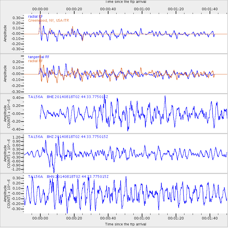
L56A Greenwood, NY, USA - Earthquake Result Viewer
*The percent match for this event was below the threshold and hence no stack was calculated.
| Earthquake location: |
Iran-Iraq Border Region |
| Earthquake latitude/longitude: |
32.7/47.7 |
| Earthquake time(UTC): |
2014/08/18 (230) 02:32:05 GMT |
| Earthquake Depth: |
10 km |
| Earthquake Magnitude: |
6.2 MWP |
| Earthquake Catalog/Contributor: |
NEIC PDE/NEIC COMCAT |
|
| Network: |
TA USArray Transportable Network (new EarthScope stations) |
| Station: |
L56A Greenwood, NY, USA |
| Lat/Lon: |
42.14 N/77.56 W |
| Elevation: |
688 m |
|
| Distance: |
90.1 deg |
| Az: |
322.586 deg |
| Baz: |
43.507 deg |
| Ray Param: |
$rayparam |
*The percent match for this event was below the threshold and hence was not used in the summary stack. |
|
| Radial Match: |
63.311523 % |
| Radial Bump: |
400 |
| Transverse Match: |
47.698544 % |
| Transverse Bump: |
400 |
| SOD ConfigId: |
769524 |
| Insert Time: |
2014-09-01 03:16:38.898 +0000 |
| GWidth: |
2.5 |
| Max Bumps: |
400 |
| Tol: |
0.001 |
|
Signal To Noise
| Channel | StoN | STA | LTA |
| TA:L56A: :BHZ:20140818T02:44:33.775015Z | 2.8986526 | 3.455216E-7 | 1.1920077E-7 |
| TA:L56A: :BHN:20140818T02:44:33.775015Z | 0.81613517 | 1.090836E-7 | 1.3365874E-7 |
| TA:L56A: :BHE:20140818T02:44:33.775015Z | 1.5933623 | 1.5756196E-7 | 9.888645E-8 |
| Arrivals |
| Ps | |
| PpPs | |
| PsPs/PpSs | |


