You are here: Home > Network List > TA - USArray Transportable Network (new EarthScope stations) Stations List
> Station P59A Jarrettsville, MD, USA > Earthquake Result Viewer
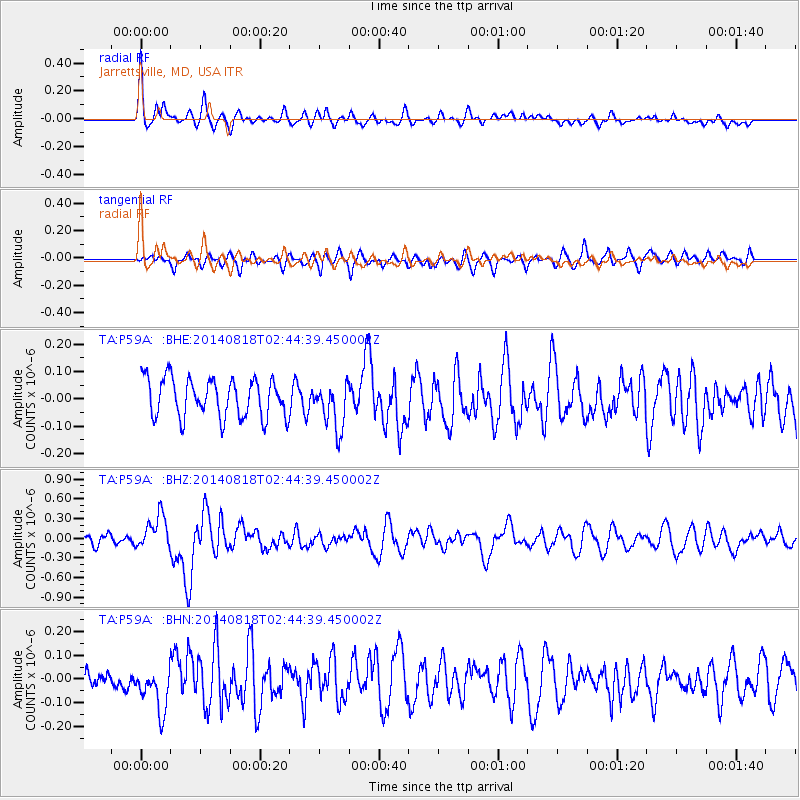
P59A Jarrettsville, MD, USA - Earthquake Result Viewer
*The percent match for this event was below the threshold and hence no stack was calculated.
| Earthquake location: |
Iran-Iraq Border Region |
| Earthquake latitude/longitude: |
32.7/47.7 |
| Earthquake time(UTC): |
2014/08/18 (230) 02:32:05 GMT |
| Earthquake Depth: |
10 km |
| Earthquake Magnitude: |
6.2 MWP |
| Earthquake Catalog/Contributor: |
NEIC PDE/NEIC COMCAT |
|
| Network: |
TA USArray Transportable Network (new EarthScope stations) |
| Station: |
P59A Jarrettsville, MD, USA |
| Lat/Lon: |
39.61 N/76.43 W |
| Elevation: |
157 m |
|
| Distance: |
91.3 deg |
| Az: |
320.221 deg |
| Baz: |
44.271 deg |
| Ray Param: |
$rayparam |
*The percent match for this event was below the threshold and hence was not used in the summary stack. |
|
| Radial Match: |
67.31665 % |
| Radial Bump: |
400 |
| Transverse Match: |
47.522476 % |
| Transverse Bump: |
400 |
| SOD ConfigId: |
769524 |
| Insert Time: |
2014-09-01 03:20:27.698 +0000 |
| GWidth: |
2.5 |
| Max Bumps: |
400 |
| Tol: |
0.001 |
|
Signal To Noise
| Channel | StoN | STA | LTA |
| TA:P59A: :BHZ:20140818T02:44:39.450002Z | 3.3816707 | 2.5992446E-7 | 7.686273E-8 |
| TA:P59A: :BHN:20140818T02:44:39.450002Z | 1.8448122 | 1.0844673E-7 | 5.87847E-8 |
| TA:P59A: :BHE:20140818T02:44:39.450002Z | 1.2110186 | 8.5002895E-8 | 7.019124E-8 |
| Arrivals |
| Ps | |
| PpPs | |
| PsPs/PpSs | |


