You are here: Home > Network List > TA - USArray Transportable Network (new EarthScope stations) Stations List
> Station T53A Wise, VA, USA > Earthquake Result Viewer
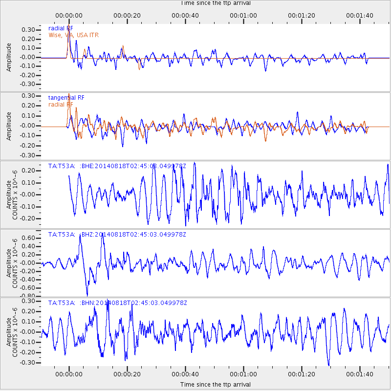
T53A Wise, VA, USA - Earthquake Result Viewer
*The percent match for this event was below the threshold and hence no stack was calculated.
| Earthquake location: |
Iran-Iraq Border Region |
| Earthquake latitude/longitude: |
32.7/47.7 |
| Earthquake time(UTC): |
2014/08/18 (230) 02:32:05 GMT |
| Earthquake Depth: |
10 km |
| Earthquake Magnitude: |
6.2 MWP |
| Earthquake Catalog/Contributor: |
NEIC PDE/NEIC COMCAT |
|
| Network: |
TA USArray Transportable Network (new EarthScope stations) |
| Station: |
T53A Wise, VA, USA |
| Lat/Lon: |
36.98 N/82.54 W |
| Elevation: |
818 m |
|
| Distance: |
96.5 deg |
| Az: |
322.009 deg |
| Baz: |
40.379 deg |
| Ray Param: |
$rayparam |
*The percent match for this event was below the threshold and hence was not used in the summary stack. |
|
| Radial Match: |
46.68848 % |
| Radial Bump: |
400 |
| Transverse Match: |
54.261024 % |
| Transverse Bump: |
400 |
| SOD ConfigId: |
769524 |
| Insert Time: |
2014-09-01 03:22:49.419 +0000 |
| GWidth: |
2.5 |
| Max Bumps: |
400 |
| Tol: |
0.001 |
|
Signal To Noise
| Channel | StoN | STA | LTA |
| TA:T53A: :BHZ:20140818T02:45:03.049978Z | 3.215418 | 2.5078808E-7 | 7.799548E-8 |
| TA:T53A: :BHN:20140818T02:45:03.049978Z | 1.6841338 | 1.0291684E-7 | 6.110966E-8 |
| TA:T53A: :BHE:20140818T02:45:03.049978Z | 2.2140393 | 1.6368558E-7 | 7.393074E-8 |
| Arrivals |
| Ps | |
| PpPs | |
| PsPs/PpSs | |


