You are here: Home > Network List > TA - USArray Transportable Network (new EarthScope stations) Stations List
> Station U57A Blanch, NC, USA > Earthquake Result Viewer
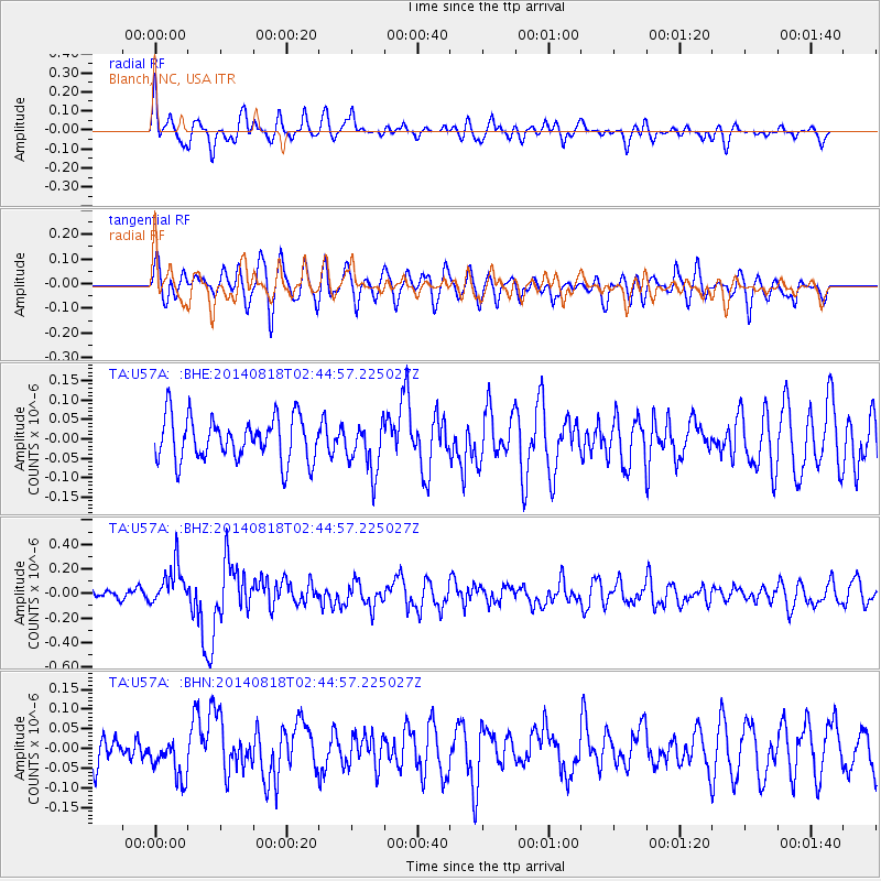
U57A Blanch, NC, USA - Earthquake Result Viewer
*The percent match for this event was below the threshold and hence no stack was calculated.
| Earthquake location: |
Iran-Iraq Border Region |
| Earthquake latitude/longitude: |
32.7/47.7 |
| Earthquake time(UTC): |
2014/08/18 (230) 02:32:05 GMT |
| Earthquake Depth: |
10 km |
| Earthquake Magnitude: |
6.2 MWP |
| Earthquake Catalog/Contributor: |
NEIC PDE/NEIC COMCAT |
|
| Network: |
TA USArray Transportable Network (new EarthScope stations) |
| Station: |
U57A Blanch, NC, USA |
| Lat/Lon: |
36.43 N/79.34 W |
| Elevation: |
178 m |
|
| Distance: |
95.2 deg |
| Az: |
319.707 deg |
| Baz: |
42.518 deg |
| Ray Param: |
$rayparam |
*The percent match for this event was below the threshold and hence was not used in the summary stack. |
|
| Radial Match: |
63.43226 % |
| Radial Bump: |
377 |
| Transverse Match: |
54.915527 % |
| Transverse Bump: |
400 |
| SOD ConfigId: |
769524 |
| Insert Time: |
2014-09-01 03:23:34.380 +0000 |
| GWidth: |
2.5 |
| Max Bumps: |
400 |
| Tol: |
0.001 |
|
Signal To Noise
| Channel | StoN | STA | LTA |
| TA:U57A: :BHZ:20140818T02:44:57.225027Z | 4.0525064 | 1.6457528E-7 | 4.0610736E-8 |
| TA:U57A: :BHN:20140818T02:44:57.225027Z | 1.0921205 | 5.0122505E-8 | 4.5894662E-8 |
| TA:U57A: :BHE:20140818T02:44:57.225027Z | 1.1625377 | 6.470896E-8 | 5.5661822E-8 |
| Arrivals |
| Ps | |
| PpPs | |
| PsPs/PpSs | |


