You are here: Home > Network List > TA - USArray Transportable Network (new EarthScope stations) Stations List
> Station V57A Coltrane Farms, NC, USA > Earthquake Result Viewer
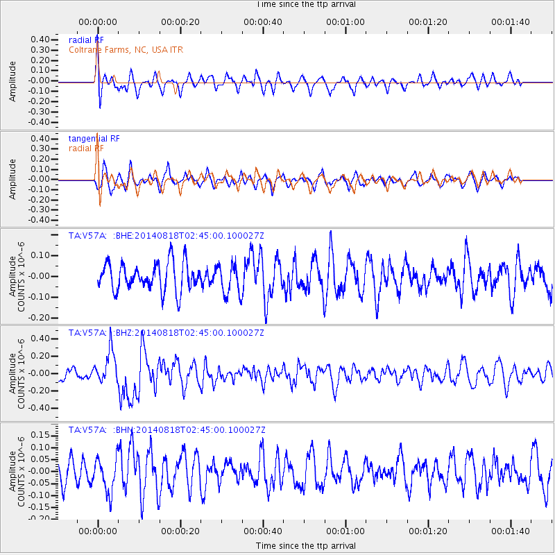
V57A Coltrane Farms, NC, USA - Earthquake Result Viewer
*The percent match for this event was below the threshold and hence no stack was calculated.
| Earthquake location: |
Iran-Iraq Border Region |
| Earthquake latitude/longitude: |
32.7/47.7 |
| Earthquake time(UTC): |
2014/08/18 (230) 02:32:05 GMT |
| Earthquake Depth: |
10 km |
| Earthquake Magnitude: |
6.2 MWP |
| Earthquake Catalog/Contributor: |
NEIC PDE/NEIC COMCAT |
|
| Network: |
TA USArray Transportable Network (new EarthScope stations) |
| Station: |
V57A Coltrane Farms, NC, USA |
| Lat/Lon: |
35.89 N/79.78 W |
| Elevation: |
223 m |
|
| Distance: |
95.9 deg |
| Az: |
319.603 deg |
| Baz: |
42.27 deg |
| Ray Param: |
$rayparam |
*The percent match for this event was below the threshold and hence was not used in the summary stack. |
|
| Radial Match: |
63.057407 % |
| Radial Bump: |
400 |
| Transverse Match: |
61.179466 % |
| Transverse Bump: |
400 |
| SOD ConfigId: |
769524 |
| Insert Time: |
2014-09-01 03:24:07.966 +0000 |
| GWidth: |
2.5 |
| Max Bumps: |
400 |
| Tol: |
0.001 |
|
Signal To Noise
| Channel | StoN | STA | LTA |
| TA:V57A: :BHZ:20140818T02:45:00.100027Z | 3.7292142 | 1.9523232E-7 | 5.2352135E-8 |
| TA:V57A: :BHN:20140818T02:45:00.100027Z | 1.6383996 | 7.2939905E-8 | 4.4518995E-8 |
| TA:V57A: :BHE:20140818T02:45:00.100027Z | 1.1399711 | 7.572433E-8 | 6.642653E-8 |
| Arrivals |
| Ps | |
| PpPs | |
| PsPs/PpSs | |


