You are here: Home > Network List > US - United States National Seismic Network Stations List
> Station DGMT Dagmar, Montana, USA > Earthquake Result Viewer
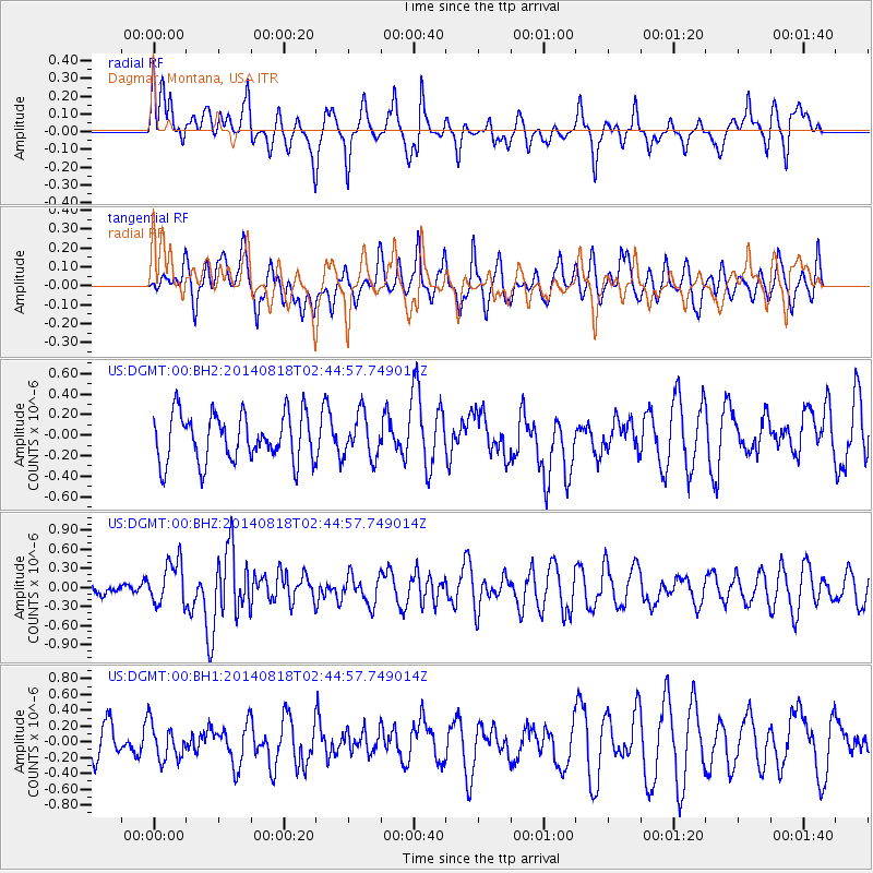
DGMT Dagmar, Montana, USA - Earthquake Result Viewer
*The percent match for this event was below the threshold and hence no stack was calculated.
| Earthquake location: |
Iran-Iraq Border Region |
| Earthquake latitude/longitude: |
32.7/47.7 |
| Earthquake time(UTC): |
2014/08/18 (230) 02:32:05 GMT |
| Earthquake Depth: |
10 km |
| Earthquake Magnitude: |
6.2 MWP |
| Earthquake Catalog/Contributor: |
NEIC PDE/NEIC COMCAT |
|
| Network: |
US United States National Seismic Network |
| Station: |
DGMT Dagmar, Montana, USA |
| Lat/Lon: |
48.47 N/104.20 W |
| Elevation: |
0.0 m |
|
| Distance: |
95.3 deg |
| Az: |
341.628 deg |
| Baz: |
23.525 deg |
| Ray Param: |
$rayparam |
*The percent match for this event was below the threshold and hence was not used in the summary stack. |
|
| Radial Match: |
55.850044 % |
| Radial Bump: |
400 |
| Transverse Match: |
67.16669 % |
| Transverse Bump: |
400 |
| SOD ConfigId: |
769524 |
| Insert Time: |
2014-09-01 03:26:24.315 +0000 |
| GWidth: |
2.5 |
| Max Bumps: |
400 |
| Tol: |
0.001 |
|
Signal To Noise
| Channel | StoN | STA | LTA |
| US:DGMT:00:BHZ:20140818T02:44:57.749014Z | 2.7691805 | 3.444913E-7 | 1.244019E-7 |
| US:DGMT:00:BH1:20140818T02:44:57.749014Z | 0.44299713 | 2.2601472E-7 | 5.101946E-7 |
| US:DGMT:00:BH2:20140818T02:44:57.749014Z | 0.89538795 | 2.0981706E-7 | 2.343309E-7 |
| Arrivals |
| Ps | |
| PpPs | |
| PsPs/PpSs | |


