You are here: Home > Network List > US - United States National Seismic Network Stations List
> Station EGMT Eagleton, Montana, USA > Earthquake Result Viewer
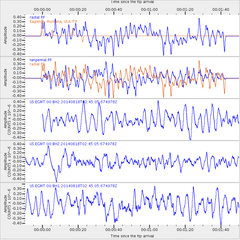
EGMT Eagleton, Montana, USA - Earthquake Result Viewer
*The percent match for this event was below the threshold and hence no stack was calculated.
| Earthquake location: |
Iran-Iraq Border Region |
| Earthquake latitude/longitude: |
32.7/47.7 |
| Earthquake time(UTC): |
2014/08/18 (230) 02:32:05 GMT |
| Earthquake Depth: |
10 km |
| Earthquake Magnitude: |
6.2 MWP |
| Earthquake Catalog/Contributor: |
NEIC PDE/NEIC COMCAT |
|
| Network: |
US United States National Seismic Network |
| Station: |
EGMT Eagleton, Montana, USA |
| Lat/Lon: |
48.02 N/109.75 W |
| Elevation: |
1055 m |
|
| Distance: |
97.1 deg |
| Az: |
344.948 deg |
| Baz: |
19.029 deg |
| Ray Param: |
$rayparam |
*The percent match for this event was below the threshold and hence was not used in the summary stack. |
|
| Radial Match: |
58.96515 % |
| Radial Bump: |
400 |
| Transverse Match: |
59.611286 % |
| Transverse Bump: |
400 |
| SOD ConfigId: |
769524 |
| Insert Time: |
2014-09-01 03:26:37.794 +0000 |
| GWidth: |
2.5 |
| Max Bumps: |
400 |
| Tol: |
0.001 |
|
Signal To Noise
| Channel | StoN | STA | LTA |
| US:EGMT:00:BHZ:20140818T02:45:05.674978Z | 1.8458892 | 1.7971504E-7 | 9.73596E-8 |
| US:EGMT:00:BH1:20140818T02:45:05.674978Z | 1.0376782 | 1.7301566E-7 | 1.6673344E-7 |
| US:EGMT:00:BH2:20140818T02:45:05.674978Z | 1.6272094 | 2.3672936E-7 | 1.454818E-7 |
| Arrivals |
| Ps | |
| PpPs | |
| PsPs/PpSs | |


