You are here: Home > Network List > AV - Alaska Volcano Observatory Stations List
> Station AMKA Regional Station, Amchitka Island, Alaska > Earthquake Result Viewer
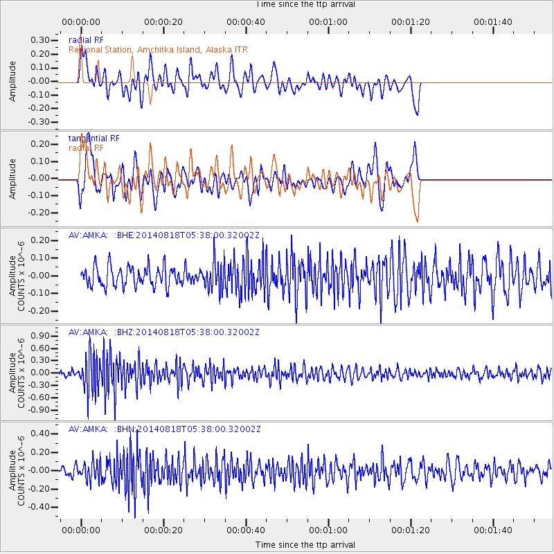
AMKA Regional Station, Amchitka Island, Alaska - Earthquake Result Viewer
*The percent match for this event was below the threshold and hence no stack was calculated.
| Earthquake location: |
Iran-Iraq Border Region |
| Earthquake latitude/longitude: |
32.7/47.8 |
| Earthquake time(UTC): |
2014/08/18 (230) 05:25:50 GMT |
| Earthquake Depth: |
10 km |
| Earthquake Magnitude: |
6.0 M |
| Earthquake Catalog/Contributor: |
NEIC PDE/NEIC ALERT |
|
| Network: |
AV Alaska Volcano Observatory |
| Station: |
AMKA Regional Station, Amchitka Island, Alaska |
| Lat/Lon: |
51.38 N/179.30 E |
| Elevation: |
116 m |
|
| Distance: |
86.1 deg |
| Az: |
28.042 deg |
| Baz: |
320.743 deg |
| Ray Param: |
$rayparam |
*The percent match for this event was below the threshold and hence was not used in the summary stack. |
|
| Radial Match: |
52.059498 % |
| Radial Bump: |
400 |
| Transverse Match: |
57.369858 % |
| Transverse Bump: |
400 |
| SOD ConfigId: |
769524 |
| Insert Time: |
2014-09-01 05:38:24.435 +0000 |
| GWidth: |
2.5 |
| Max Bumps: |
400 |
| Tol: |
0.001 |
|
Signal To Noise
| Channel | StoN | STA | LTA |
| AV:AMKA: :BHZ:20140818T05:38:00.32002Z | 7.2315965 | 4.251156E-7 | 5.8785854E-8 |
| AV:AMKA: :BHN:20140818T05:38:00.32002Z | 1.867346 | 9.3917286E-8 | 5.0294528E-8 |
| AV:AMKA: :BHE:20140818T05:38:00.32002Z | 1.4346901 | 7.8680635E-8 | 5.4841554E-8 |
| Arrivals |
| Ps | |
| PpPs | |
| PsPs/PpSs | |


