You are here: Home > Network List > NE - New England Seismic Network Stations List
> Station EMMW Machias, ME, USA > Earthquake Result Viewer
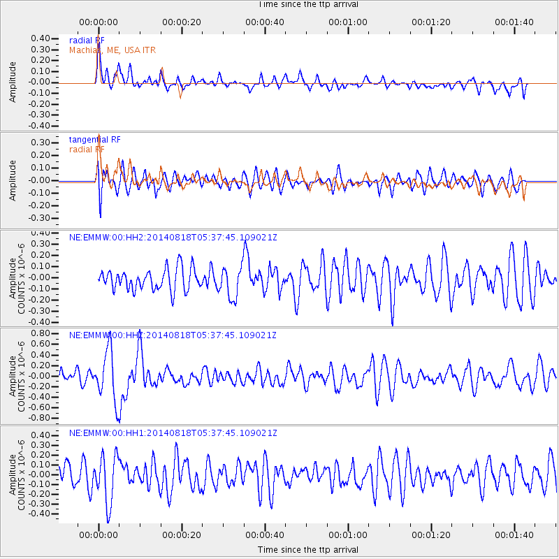
EMMW Machias, ME, USA - Earthquake Result Viewer
*The percent match for this event was below the threshold and hence no stack was calculated.
| Earthquake location: |
Iran-Iraq Border Region |
| Earthquake latitude/longitude: |
32.7/47.8 |
| Earthquake time(UTC): |
2014/08/18 (230) 05:25:50 GMT |
| Earthquake Depth: |
10 km |
| Earthquake Magnitude: |
6.0 M |
| Earthquake Catalog/Contributor: |
NEIC PDE/NEIC ALERT |
|
| Network: |
NE New England Seismic Network |
| Station: |
EMMW Machias, ME, USA |
| Lat/Lon: |
44.71 N/67.46 W |
| Elevation: |
35 m |
|
| Distance: |
83.1 deg |
| Az: |
319.469 deg |
| Baz: |
50.248 deg |
| Ray Param: |
$rayparam |
*The percent match for this event was below the threshold and hence was not used in the summary stack. |
|
| Radial Match: |
52.60301 % |
| Radial Bump: |
373 |
| Transverse Match: |
57.541183 % |
| Transverse Bump: |
400 |
| SOD ConfigId: |
769524 |
| Insert Time: |
2014-09-01 05:51:53.479 +0000 |
| GWidth: |
2.5 |
| Max Bumps: |
400 |
| Tol: |
0.001 |
|
Signal To Noise
| Channel | StoN | STA | LTA |
| NE:EMMW:00:HHZ:20140818T05:37:45.109021Z | 4.452732 | 4.9275013E-7 | 1.1066242E-7 |
| NE:EMMW:00:HH1:20140818T05:37:45.109021Z | 2.9921334 | 2.4742315E-7 | 8.2691216E-8 |
| NE:EMMW:00:HH2:20140818T05:37:45.109021Z | 1.4984232 | 1.4050315E-7 | 9.376733E-8 |
| Arrivals |
| Ps | |
| PpPs | |
| PsPs/PpSs | |


