You are here: Home > Network List > TA - USArray Transportable Network (new EarthScope stations) Stations List
> Station O03E Paynes Creek, CA, USA > Earthquake Result Viewer
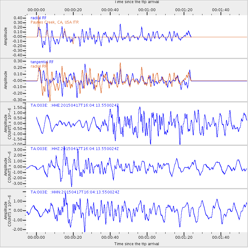
O03E Paynes Creek, CA, USA - Earthquake Result Viewer
*The percent match for this event was below the threshold and hence no stack was calculated.
| Earthquake location: |
Fiji Islands Region |
| Earthquake latitude/longitude: |
-15.9/-178.6 |
| Earthquake time(UTC): |
2015/04/17 (107) 15:52:51 GMT |
| Earthquake Depth: |
10 km |
| Earthquake Magnitude: |
6.5 MWW, 6.8 MI |
| Earthquake Catalog/Contributor: |
NEIC PDE/NEIC COMCAT |
|
| Network: |
TA USArray Transportable Network (new EarthScope stations) |
| Station: |
O03E Paynes Creek, CA, USA |
| Lat/Lon: |
40.29 N/121.80 W |
| Elevation: |
967 m |
|
| Distance: |
76.8 deg |
| Az: |
41.083 deg |
| Baz: |
235.759 deg |
| Ray Param: |
$rayparam |
*The percent match for this event was below the threshold and hence was not used in the summary stack. |
|
| Radial Match: |
78.26716 % |
| Radial Bump: |
400 |
| Transverse Match: |
48.8928 % |
| Transverse Bump: |
386 |
| SOD ConfigId: |
7422571 |
| Insert Time: |
2019-04-18 05:50:48.564 +0000 |
| GWidth: |
2.5 |
| Max Bumps: |
400 |
| Tol: |
0.001 |
|
Signal To Noise
| Channel | StoN | STA | LTA |
| TA:O03E: :HHZ:20150417T16:04:13.550024Z | 1.5818349 | 3.636478E-7 | 2.2988986E-7 |
| TA:O03E: :HHN:20150417T16:04:13.550024Z | 1.0015196 | 3.2973685E-7 | 3.292365E-7 |
| TA:O03E: :HHE:20150417T16:04:13.550024Z | 1.0810004 | 4.0679046E-7 | 3.7630923E-7 |
| Arrivals |
| Ps | |
| PpPs | |
| PsPs/PpSs | |


