You are here: Home > Network List > TA - USArray Transportable Network (new EarthScope stations) Stations List
> Station R11A Troy Canyon, Currant, NV, USA > Earthquake Result Viewer
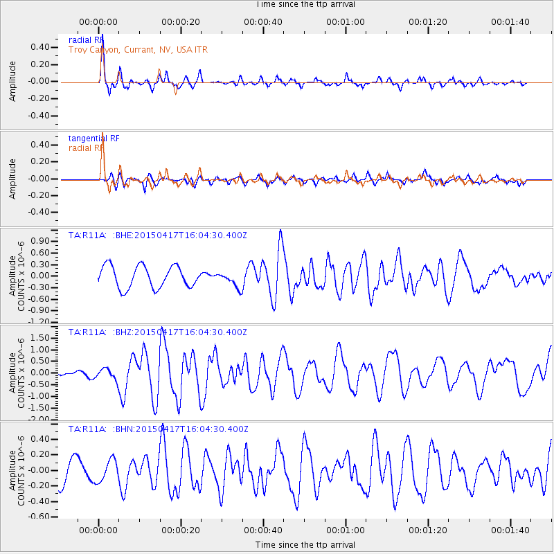
R11A Troy Canyon, Currant, NV, USA - Earthquake Result Viewer
*The percent match for this event was below the threshold and hence no stack was calculated.
| Earthquake location: |
Fiji Islands Region |
| Earthquake latitude/longitude: |
-15.9/-178.6 |
| Earthquake time(UTC): |
2015/04/17 (107) 15:52:51 GMT |
| Earthquake Depth: |
10 km |
| Earthquake Magnitude: |
6.5 MWW, 6.8 MI |
| Earthquake Catalog/Contributor: |
NEIC PDE/NEIC COMCAT |
|
| Network: |
TA USArray Transportable Network (new EarthScope stations) |
| Station: |
R11A Troy Canyon, Currant, NV, USA |
| Lat/Lon: |
38.35 N/115.59 W |
| Elevation: |
1756 m |
|
| Distance: |
79.9 deg |
| Az: |
45.363 deg |
| Baz: |
240.549 deg |
| Ray Param: |
$rayparam |
*The percent match for this event was below the threshold and hence was not used in the summary stack. |
|
| Radial Match: |
79.453026 % |
| Radial Bump: |
400 |
| Transverse Match: |
68.43693 % |
| Transverse Bump: |
400 |
| SOD ConfigId: |
7422571 |
| Insert Time: |
2019-04-18 05:50:50.554 +0000 |
| GWidth: |
2.5 |
| Max Bumps: |
400 |
| Tol: |
0.001 |
|
Signal To Noise
| Channel | StoN | STA | LTA |
| TA:R11A: :BHZ:20150417T16:04:30.400Z | 1.7097536 | 2.3303596E-7 | 1.3629798E-7 |
| TA:R11A: :BHN:20150417T16:04:30.400Z | 0.72760653 | 1.4074946E-7 | 1.9344174E-7 |
| TA:R11A: :BHE:20150417T16:04:30.400Z | 0.33565432 | 9.669511E-8 | 2.8807946E-7 |
| Arrivals |
| Ps | |
| PpPs | |
| PsPs/PpSs | |


