You are here: Home > Network List > TA - USArray Transportable Network (new EarthScope stations) Stations List
> Station Q56A Snyder Ridge, Maysville, WV, USA > Earthquake Result Viewer
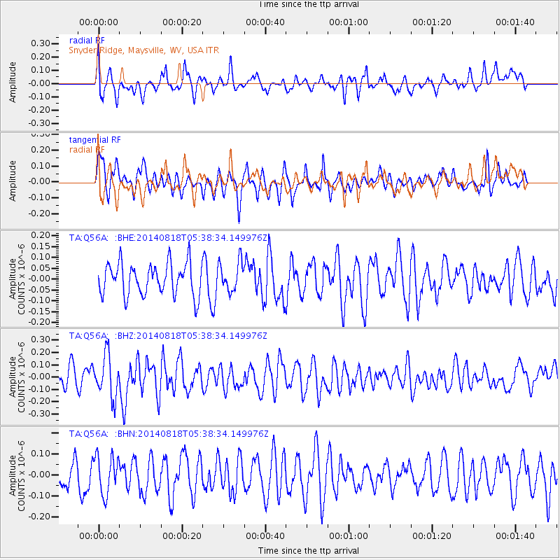
Q56A Snyder Ridge, Maysville, WV, USA - Earthquake Result Viewer
*The percent match for this event was below the threshold and hence no stack was calculated.
| Earthquake location: |
Iran-Iraq Border Region |
| Earthquake latitude/longitude: |
32.7/47.8 |
| Earthquake time(UTC): |
2014/08/18 (230) 05:25:50 GMT |
| Earthquake Depth: |
10 km |
| Earthquake Magnitude: |
6.0 M |
| Earthquake Catalog/Contributor: |
NEIC PDE/NEIC ALERT |
|
| Network: |
TA USArray Transportable Network (new EarthScope stations) |
| Station: |
Q56A Snyder Ridge, Maysville, WV, USA |
| Lat/Lon: |
39.04 N/79.19 W |
| Elevation: |
430 m |
|
| Distance: |
93.3 deg |
| Az: |
321.429 deg |
| Baz: |
42.485 deg |
| Ray Param: |
$rayparam |
*The percent match for this event was below the threshold and hence was not used in the summary stack. |
|
| Radial Match: |
57.958576 % |
| Radial Bump: |
400 |
| Transverse Match: |
48.581905 % |
| Transverse Bump: |
360 |
| SOD ConfigId: |
769524 |
| Insert Time: |
2014-09-01 06:05:45.451 +0000 |
| GWidth: |
2.5 |
| Max Bumps: |
400 |
| Tol: |
0.001 |
|
Signal To Noise
| Channel | StoN | STA | LTA |
| TA:Q56A: :BHZ:20140818T05:38:34.149976Z | 2.3069189 | 1.7387947E-7 | 7.537303E-8 |
| TA:Q56A: :BHN:20140818T05:38:34.149976Z | 1.5230856 | 9.089186E-8 | 5.967613E-8 |
| TA:Q56A: :BHE:20140818T05:38:34.149976Z | 0.9253868 | 6.801023E-8 | 7.349384E-8 |
| Arrivals |
| Ps | |
| PpPs | |
| PsPs/PpSs | |


