You are here: Home > Network List > TA - USArray Transportable Network (new EarthScope stations) Stations List
> Station R54A Victor, WV, USA > Earthquake Result Viewer
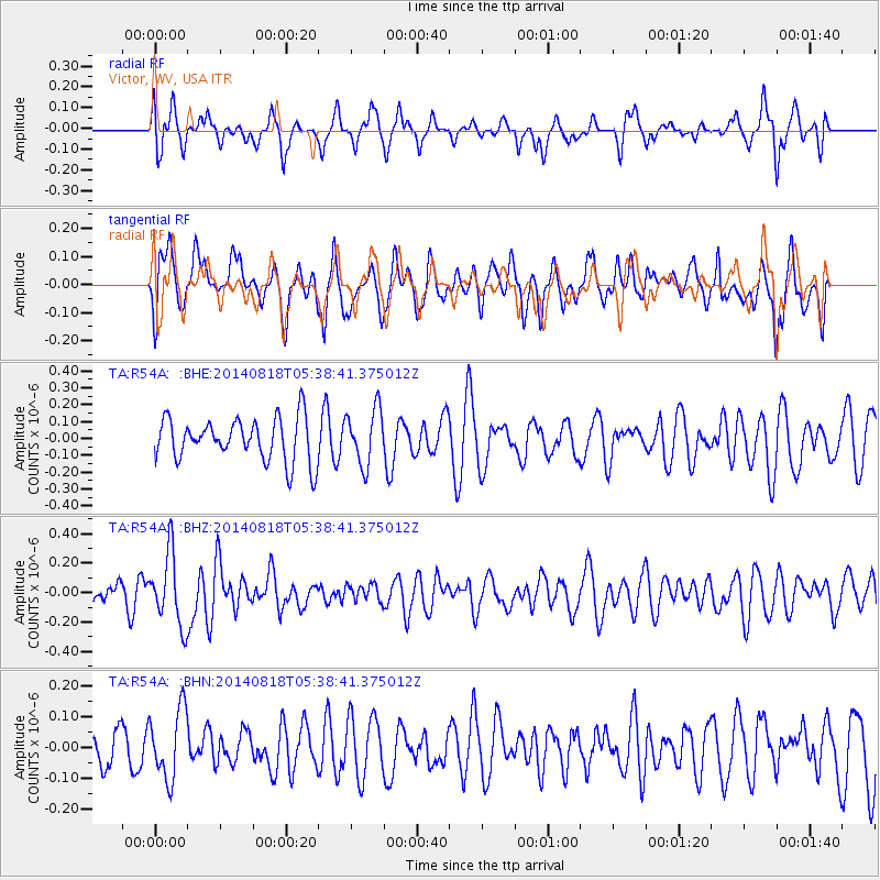
R54A Victor, WV, USA - Earthquake Result Viewer
*The percent match for this event was below the threshold and hence no stack was calculated.
| Earthquake location: |
Iran-Iraq Border Region |
| Earthquake latitude/longitude: |
32.7/47.8 |
| Earthquake time(UTC): |
2014/08/18 (230) 05:25:50 GMT |
| Earthquake Depth: |
10 km |
| Earthquake Magnitude: |
6.0 M |
| Earthquake Catalog/Contributor: |
NEIC PDE/NEIC ALERT |
|
| Network: |
TA USArray Transportable Network (new EarthScope stations) |
| Station: |
R54A Victor, WV, USA |
| Lat/Lon: |
38.18 N/80.99 W |
| Elevation: |
512 m |
|
| Distance: |
94.9 deg |
| Az: |
321.908 deg |
| Baz: |
41.33 deg |
| Ray Param: |
$rayparam |
*The percent match for this event was below the threshold and hence was not used in the summary stack. |
|
| Radial Match: |
56.06656 % |
| Radial Bump: |
400 |
| Transverse Match: |
51.14101 % |
| Transverse Bump: |
400 |
| SOD ConfigId: |
769524 |
| Insert Time: |
2014-09-01 06:06:09.164 +0000 |
| GWidth: |
2.5 |
| Max Bumps: |
400 |
| Tol: |
0.001 |
|
Signal To Noise
| Channel | StoN | STA | LTA |
| TA:R54A: :BHZ:20140818T05:38:41.375012Z | 3.5556521 | 2.4289088E-7 | 6.83112E-8 |
| TA:R54A: :BHN:20140818T05:38:41.375012Z | 1.9494745 | 1.13468225E-7 | 5.820452E-8 |
| TA:R54A: :BHE:20140818T05:38:41.375012Z | 1.2898972 | 1.6503525E-7 | 1.2794449E-7 |
| Arrivals |
| Ps | |
| PpPs | |
| PsPs/PpSs | |


