You are here: Home > Network List > TA - USArray Transportable Network (new EarthScope stations) Stations List
> Station T57A Hurt, VA, USA > Earthquake Result Viewer
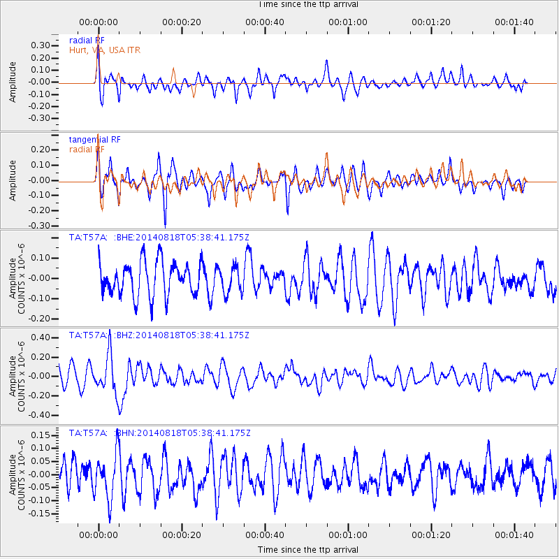
T57A Hurt, VA, USA - Earthquake Result Viewer
*The percent match for this event was below the threshold and hence no stack was calculated.
| Earthquake location: |
Iran-Iraq Border Region |
| Earthquake latitude/longitude: |
32.7/47.8 |
| Earthquake time(UTC): |
2014/08/18 (230) 05:25:50 GMT |
| Earthquake Depth: |
10 km |
| Earthquake Magnitude: |
6.0 M |
| Earthquake Catalog/Contributor: |
NEIC PDE/NEIC ALERT |
|
| Network: |
TA USArray Transportable Network (new EarthScope stations) |
| Station: |
T57A Hurt, VA, USA |
| Lat/Lon: |
37.00 N/79.25 W |
| Elevation: |
230 m |
|
| Distance: |
94.9 deg |
| Az: |
320.086 deg |
| Baz: |
42.54 deg |
| Ray Param: |
$rayparam |
*The percent match for this event was below the threshold and hence was not used in the summary stack. |
|
| Radial Match: |
61.47695 % |
| Radial Bump: |
400 |
| Transverse Match: |
60.856087 % |
| Transverse Bump: |
375 |
| SOD ConfigId: |
769524 |
| Insert Time: |
2014-09-01 06:07:02.271 +0000 |
| GWidth: |
2.5 |
| Max Bumps: |
400 |
| Tol: |
0.001 |
|
Signal To Noise
| Channel | StoN | STA | LTA |
| TA:T57A: :BHZ:20140818T05:38:41.175Z | 2.104083 | 1.998768E-7 | 9.499473E-8 |
| TA:T57A: :BHN:20140818T05:38:41.175Z | 1.7822312 | 8.937015E-8 | 5.0145093E-8 |
| TA:T57A: :BHE:20140818T05:38:41.175Z | 0.776572 | 6.419393E-8 | 8.26632E-8 |
| Arrivals |
| Ps | |
| PpPs | |
| PsPs/PpSs | |


