You are here: Home > Network List > AV - Alaska Volcano Observatory Stations List
> Station AMKA Regional Station, Amchitka Island, Alaska > Earthquake Result Viewer
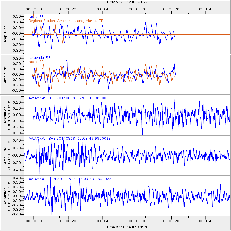
AMKA Regional Station, Amchitka Island, Alaska - Earthquake Result Viewer
*The percent match for this event was below the threshold and hence no stack was calculated.
| Earthquake location: |
Iran-Iraq Border Region |
| Earthquake latitude/longitude: |
32.7/47.5 |
| Earthquake time(UTC): |
2014/08/18 (230) 11:51:34 GMT |
| Earthquake Depth: |
10 km |
| Earthquake Magnitude: |
5.8 MB |
| Earthquake Catalog/Contributor: |
NEIC PDE/NEIC COMCAT |
|
| Network: |
AV Alaska Volcano Observatory |
| Station: |
AMKA Regional Station, Amchitka Island, Alaska |
| Lat/Lon: |
51.38 N/179.30 E |
| Elevation: |
116 m |
|
| Distance: |
86.1 deg |
| Az: |
27.944 deg |
| Baz: |
320.922 deg |
| Ray Param: |
$rayparam |
*The percent match for this event was below the threshold and hence was not used in the summary stack. |
|
| Radial Match: |
49.984837 % |
| Radial Bump: |
400 |
| Transverse Match: |
62.28112 % |
| Transverse Bump: |
400 |
| SOD ConfigId: |
769524 |
| Insert Time: |
2014-09-01 11:58:04.562 +0000 |
| GWidth: |
2.5 |
| Max Bumps: |
400 |
| Tol: |
0.001 |
|
Signal To Noise
| Channel | StoN | STA | LTA |
| AV:AMKA: :BHZ:20140818T12:03:43.980002Z | 2.2715197 | 2.061402E-7 | 9.07499E-8 |
| AV:AMKA: :BHN:20140818T12:03:43.980002Z | 0.8648276 | 6.921248E-8 | 8.003038E-8 |
| AV:AMKA: :BHE:20140818T12:03:43.980002Z | 0.6752847 | 5.385263E-8 | 7.974805E-8 |
| Arrivals |
| Ps | |
| PpPs | |
| PsPs/PpSs | |


