You are here: Home > Network List > CN - Canadian National Seismograph Network Stations List
> Station INK INUVIK, NT > Earthquake Result Viewer
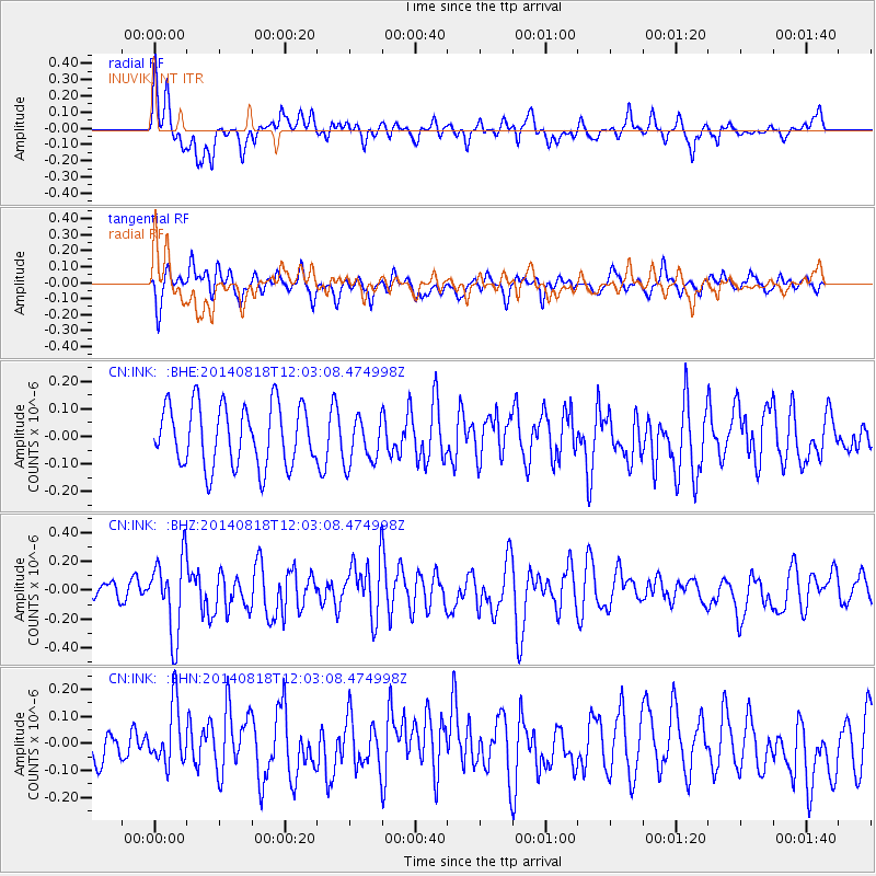
INK INUVIK, NT - Earthquake Result Viewer
*The percent match for this event was below the threshold and hence no stack was calculated.
| Earthquake location: |
Iran-Iraq Border Region |
| Earthquake latitude/longitude: |
32.7/47.5 |
| Earthquake time(UTC): |
2014/08/18 (230) 11:51:34 GMT |
| Earthquake Depth: |
10 km |
| Earthquake Magnitude: |
5.8 MB |
| Earthquake Catalog/Contributor: |
NEIC PDE/NEIC COMCAT |
|
| Network: |
CN Canadian National Seismograph Network |
| Station: |
INK INUVIK, NT |
| Lat/Lon: |
68.31 N/133.53 W |
| Elevation: |
44 m |
|
| Distance: |
79.3 deg |
| Az: |
0.406 deg |
| Baz: |
359.08 deg |
| Ray Param: |
$rayparam |
*The percent match for this event was below the threshold and hence was not used in the summary stack. |
|
| Radial Match: |
66.636734 % |
| Radial Bump: |
400 |
| Transverse Match: |
64.752975 % |
| Transverse Bump: |
400 |
| SOD ConfigId: |
769524 |
| Insert Time: |
2014-09-01 12:00:04.977 +0000 |
| GWidth: |
2.5 |
| Max Bumps: |
400 |
| Tol: |
0.001 |
|
Signal To Noise
| Channel | StoN | STA | LTA |
| CN:INK: :BHZ:20140818T12:03:08.474998Z | 2.9709158 | 2.647691E-7 | 8.912036E-8 |
| CN:INK: :BHN:20140818T12:03:08.474998Z | 1.6803166 | 1.09614135E-7 | 6.523421E-8 |
| CN:INK: :BHE:20140818T12:03:08.474998Z | 0.77445287 | 8.555247E-8 | 1.1046827E-7 |
| Arrivals |
| Ps | |
| PpPs | |
| PsPs/PpSs | |


