You are here: Home > Network List > IU - Global Seismograph Network (GSN - IRIS/USGS) Stations List
> Station POHA Pohakuloa, Hawaii, USA > Earthquake Result Viewer
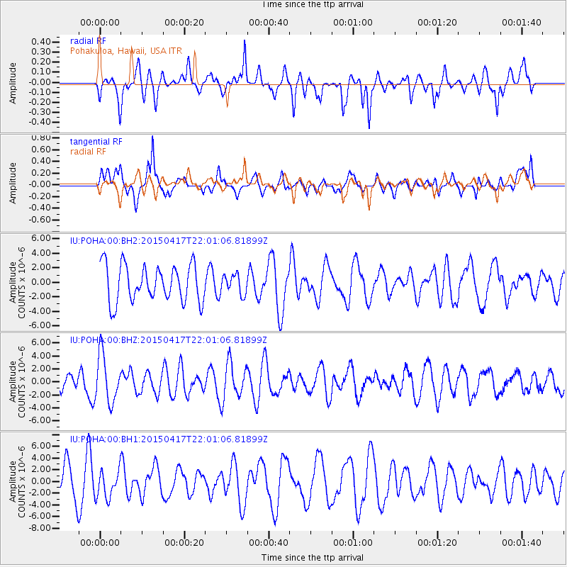
POHA Pohakuloa, Hawaii, USA - Earthquake Result Viewer
*The percent match for this event was below the threshold and hence no stack was calculated.
| Earthquake location: |
South Of Fiji Islands |
| Earthquake latitude/longitude: |
-25.3/-176.2 |
| Earthquake time(UTC): |
2015/04/17 (107) 21:52:52 GMT |
| Earthquake Depth: |
21 km |
| Earthquake Magnitude: |
5.2 MW, 5.0 mb, 4.6 MS |
| Earthquake Catalog/Contributor: |
ISC/ISC |
|
| Network: |
IU Global Seismograph Network (GSN - IRIS/USGS) |
| Station: |
POHA Pohakuloa, Hawaii, USA |
| Lat/Lon: |
19.76 N/155.53 W |
| Elevation: |
1990 m |
|
| Distance: |
49.1 deg |
| Az: |
26.048 deg |
| Baz: |
204.961 deg |
| Ray Param: |
$rayparam |
*The percent match for this event was below the threshold and hence was not used in the summary stack. |
|
| Radial Match: |
61.454758 % |
| Radial Bump: |
400 |
| Transverse Match: |
49.332302 % |
| Transverse Bump: |
400 |
| SOD ConfigId: |
7422571 |
| Insert Time: |
2019-04-18 05:55:49.431 +0000 |
| GWidth: |
2.5 |
| Max Bumps: |
400 |
| Tol: |
0.001 |
|
Signal To Noise
| Channel | StoN | STA | LTA |
| IU:POHA:00:BHZ:20150417T22:01:06.81899Z | 2.0746837 | 3.7073116E-6 | 1.7869288E-6 |
| IU:POHA:00:BH1:20150417T22:01:06.81899Z | 0.93686914 | 2.3252935E-6 | 2.481983E-6 |
| IU:POHA:00:BH2:20150417T22:01:06.81899Z | 0.5331449 | 1.3488227E-6 | 2.5299366E-6 |
| Arrivals |
| Ps | |
| PpPs | |
| PsPs/PpSs | |


