You are here: Home > Network List > TA - USArray Transportable Network (new EarthScope stations) Stations List
> Station A04D Lummi Island, WA, USA > Earthquake Result Viewer
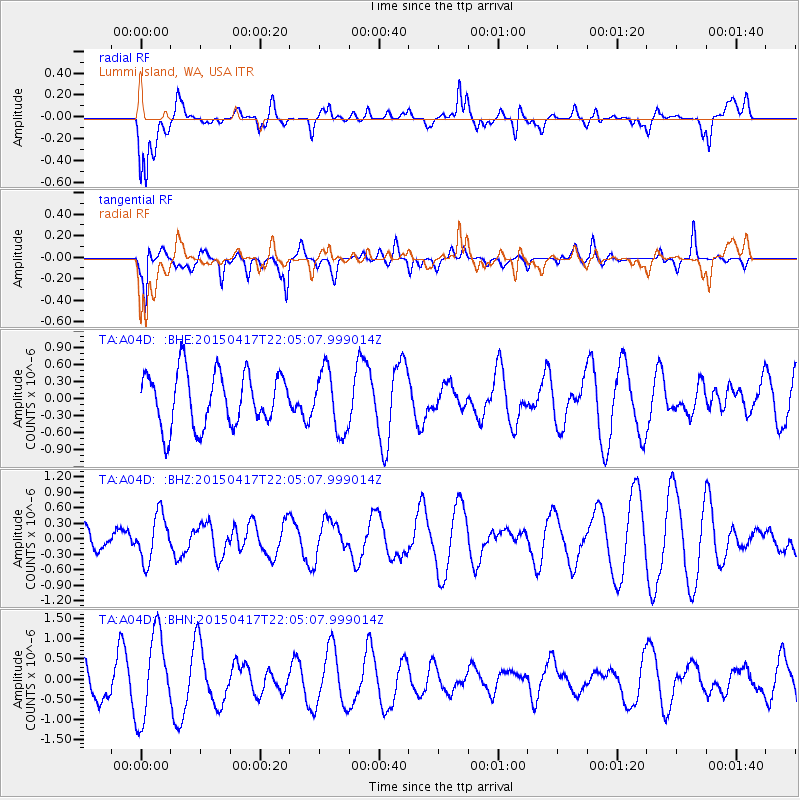
A04D Lummi Island, WA, USA - Earthquake Result Viewer
*The percent match for this event was below the threshold and hence no stack was calculated.
| Earthquake location: |
South Of Fiji Islands |
| Earthquake latitude/longitude: |
-25.3/-176.2 |
| Earthquake time(UTC): |
2015/04/17 (107) 21:52:52 GMT |
| Earthquake Depth: |
21 km |
| Earthquake Magnitude: |
5.2 MW, 5.0 mb, 4.6 MS |
| Earthquake Catalog/Contributor: |
ISC/ISC |
|
| Network: |
TA USArray Transportable Network (new EarthScope stations) |
| Station: |
A04D Lummi Island, WA, USA |
| Lat/Lon: |
48.72 N/122.71 W |
| Elevation: |
13 m |
|
| Distance: |
87.8 deg |
| Az: |
32.17 deg |
| Baz: |
226.694 deg |
| Ray Param: |
$rayparam |
*The percent match for this event was below the threshold and hence was not used in the summary stack. |
|
| Radial Match: |
47.288296 % |
| Radial Bump: |
400 |
| Transverse Match: |
56.074543 % |
| Transverse Bump: |
400 |
| SOD ConfigId: |
7422571 |
| Insert Time: |
2019-04-18 05:57:07.924 +0000 |
| GWidth: |
2.5 |
| Max Bumps: |
400 |
| Tol: |
0.001 |
|
Signal To Noise
| Channel | StoN | STA | LTA |
| TA:A04D: :BHZ:20150417T22:05:07.999014Z | 1.498698 | 4.462741E-7 | 2.977745E-7 |
| TA:A04D: :BHN:20150417T22:05:07.999014Z | 3.0629976 | 1.0541311E-6 | 3.4415015E-7 |
| TA:A04D: :BHE:20150417T22:05:07.999014Z | 1.1389838 | 5.3672926E-7 | 4.7123515E-7 |
| Arrivals |
| Ps | |
| PpPs | |
| PsPs/PpSs | |


