You are here: Home > Network List > TA - USArray Transportable Network (new EarthScope stations) Stations List
> Station J62A Henniker, NH, USA > Earthquake Result Viewer
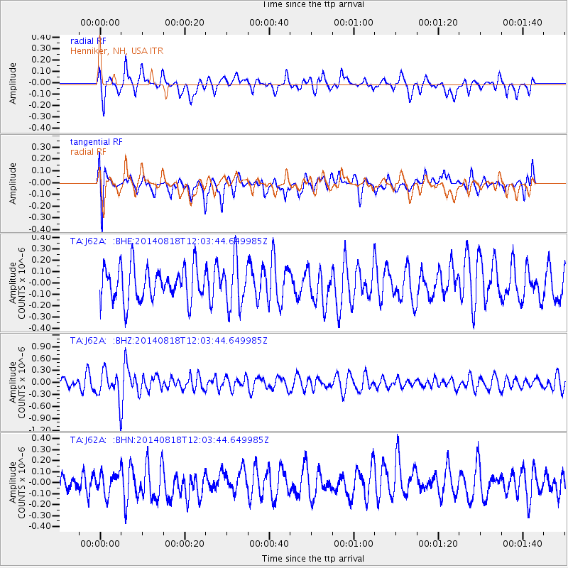
J62A Henniker, NH, USA - Earthquake Result Viewer
*The percent match for this event was below the threshold and hence no stack was calculated.
| Earthquake location: |
Iran-Iraq Border Region |
| Earthquake latitude/longitude: |
32.7/47.5 |
| Earthquake time(UTC): |
2014/08/18 (230) 11:51:34 GMT |
| Earthquake Depth: |
10 km |
| Earthquake Magnitude: |
5.8 MB |
| Earthquake Catalog/Contributor: |
NEIC PDE/NEIC COMCAT |
|
| Network: |
TA USArray Transportable Network (new EarthScope stations) |
| Station: |
J62A Henniker, NH, USA |
| Lat/Lon: |
43.23 N/71.81 W |
| Elevation: |
266 m |
|
| Distance: |
86.3 deg |
| Az: |
320.327 deg |
| Baz: |
47.423 deg |
| Ray Param: |
$rayparam |
*The percent match for this event was below the threshold and hence was not used in the summary stack. |
|
| Radial Match: |
59.51407 % |
| Radial Bump: |
400 |
| Transverse Match: |
52.51036 % |
| Transverse Bump: |
400 |
| SOD ConfigId: |
769524 |
| Insert Time: |
2014-09-01 12:18:00.947 +0000 |
| GWidth: |
2.5 |
| Max Bumps: |
400 |
| Tol: |
0.001 |
|
Signal To Noise
| Channel | StoN | STA | LTA |
| TA:J62A: :BHZ:20140818T12:03:44.649985Z | 2.2832088 | 3.5069576E-7 | 1.5359777E-7 |
| TA:J62A: :BHN:20140818T12:03:44.649985Z | 0.90210193 | 9.8824096E-8 | 1.095487E-7 |
| TA:J62A: :BHE:20140818T12:03:44.649985Z | 1.4268913 | 2.1138719E-7 | 1.4814526E-7 |
| Arrivals |
| Ps | |
| PpPs | |
| PsPs/PpSs | |


